
 Search
 Feedback
 About
About Help
Help News
News
| Listing 1 - 10 of 16 | << page >> |
Sort by
|
ISBN: 1281970220 9786611970222 1554882249 9781554882243 9781459712546 1459712544 1550025627 9781550025620 1903365643 9781903365649 Year: 2004 Publisher: Toronto Dundurn Group
Abstract | Keywords | Export | Availability | Bookmark
 Loading...
Choose an application
- Reference Manager
- EndNote
- RefWorks (Direct export to RefWorks)
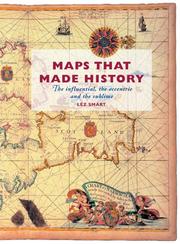
Features 25 glorious maps that chart societies, land, sea, and skies; maps that have influenced and inspired; and maps that misrepresent.
Periodical
ISSN: 03085694 14797801 Year: 1935 Publisher: Lympne,
Abstract | Keywords | Export | Availability | Bookmark
Loading...Choose an application
- Reference Manager
- EndNote
- RefWorks (Direct export to RefWorks)
Imago Mundi is the only English-language scholarly periodical devoted exclusively to the history of pre-modern maps, mapping, and map-related ideas from anywhere in the world. It was founded in Berlin in 1935 by the Russian émigré Leo Bagrow as an annual publication, although only five volumes appeared between 1935 and 1948. From 1975 to 2003 publication was regular. In 2004 Imago Mundi became a biannual publication. The first volume was in German. Thereafter English was used with, very occasionally, French. After 2002 (volume 54) Imago Mundi publishes exclusively in English with foreign language abstracts (currently French, German, and Spanish). A multi-disciplinary approach was adopted in 1995. All articles represent original research, are refereed, and are well illustrated (recent volumes have included color plates). Since 1977 each volume has contained a full complement of scholarly aids in the form of book reviews, bibliography, and chronicles, all of which have made Imago Mundi a valuable journal of record as well as scholarship.
cartografie --- Cartography --- Early maps --- Cartographie --- Cartes anciennes --- Architecture, Fine and Decorative Arts. --- Arts and Humanities. --- Arts and Humanities --- Earth Sciences --- Architecture, Fine and Decorative Arts --- History --- Geodesy. Cartography --- 912 <09> --- 912 <05> --- Cartografie. Kaarten. Plattegronden. Atlassen--Geschiedenis van ... --- Cartografie. Kaarten. Plattegronden. Atlassen--Tijdschriften --- Periodicals --- Cartography. --- Early maps. --- History (General) --- Geography & Cartography. --- Maps, Early --- Geography --- Cartography, Primitive --- Chartography --- Map-making --- Mapmaking --- Mapping (Cartography) --- Mathematical geography --- Surveying --- Map projection --- Maps --- cartography [discipline] --- Cartografie. Kaarten. Plattegronden. Atlassen--Geschiedenis van .. --- Cartografie. Kaarten. Plattegronden. Atlassen--Geschiedenis van . --- Cartografie. Kaarten. Plattegronden. Atlassen--Geschiedenis van --- Cartography - Periodicals. --- Early maps - Periodicals. --- Cartographie - Périodiques. --- Cartes anciennes - Périodiques.
ISBN: 0807830003 9780807830000 080785672X 9780807856727 9781469601014 146960101X 0807838977 9798890878038 Year: 2006 Publisher: Chapel Hill University of North Carolina Press
Abstract | Keywords | Export | Availability | Bookmark
Loading...Choose an application
- Reference Manager
- EndNote
- RefWorks (Direct export to RefWorks)
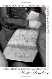
The rapid rise in popularity of maps and geography handbooks in the eighteenth century ushered in a new geographic literacy among non elite Americans. In a path breaking and richly illustrated examination of this transformation, Martin Brückner argues that geographic literacy as it was played out in popular literary genres significantly influenced the formation of identity in America from the 1680s to the 1820s. Drawing on historical geography, cartography, literary history, and material culture, Brückner recovers a vibrant culture of geography consisting of property plats and surveying manuals, decorative wall maps and school geographies, the nation's first atlases, and sentimental objects such as needlework samplers. By showing how this geographic revolution affected the production of literature, Brückner demonstrates that the internalization of geography as a kind of language helped shape the literary construction of the modern American subject.
Book
ISBN: 9004400893 9789004400894 9004400885 9789004400887 Year: 2020 Publisher: Leiden Brill
Abstract | Keywords | Export | Availability | Bookmark
Loading...Choose an application
- Reference Manager
- EndNote
- RefWorks (Direct export to RefWorks)
"When does a depiction of the moon become a lunar map? This publication addresses this question from theoretical and historical standpoints. It is argued that moon maps are of crucial importance to the history of cartography, for they challenge established notions of what a map is, how it functions, what its purposes are, and what kind of power it embodies and performs. The publication also shows how terrestrial cartography has shaped the history of lunar mapping since the seventeenth century, through visual and nomenclature conventions, the cultural currency of maps, mapmakers' social standing, and data-gathering and projection practices. It further demonstrates that lunar cartography has also been organized by an internal principle that is born of the fundamental problem of how to create static map spaces capable of representing a referent that is constantly changing to our eyes, as is the visible face of the moon. It is suggested that moon maps may be classed in three broad categories, according to the kinds of solutions for this representational problem that have been devised over the last 400 years".
912:523.34 --- 912 <09> --- History --- 912:523.34 Cartografie. Kaarten. Plattegronden. Atlassen-:-Moon. Selenology --- 912:523.34 Cartography. Maps. Atlasses-:-Moon. Selenology --- Cartografie. Kaarten. Plattegronden. Atlassen-:-Moon. Selenology --- Cartography. Maps. Atlasses-:-Moon. Selenology --- Annals --- Auxiliary sciences of history --- 912 <09> Cartografie. Kaarten. Plattegronden. Atlassen--Geschiedenis van ... --- 912 <09> Cartography. Maps. Atlasses--Geschiedenis van ... --- Cartografie. Kaarten. Plattegronden. Atlassen--Geschiedenis van ... --- Cartography. Maps. Atlasses--Geschiedenis van ... --- Cartografie. Kaarten. Plattegronden. Atlassen--Geschiedenis van . --- History of cartography. --- E-books --- Cartografie. Kaarten. Plattegronden. Atlassen--Geschiedenis van --- History. --- Moon --- Maps --- Earth (Planet) --- Satellite --- Solar system --- Geodesy. Cartography --- historical maps --- anno 1600-1699 --- anno 1800-1999 --- anno 1700-1799
Book
ISBN: 9789004438033 9789004387904 9004438033 9004387900 Year: 2020 Publisher: Leiden Brill
Abstract | Keywords | Export | Availability | Bookmark
Loading...Choose an application
- Reference Manager
- EndNote
- RefWorks (Direct export to RefWorks)
Since antiquity, artists have visualized the known world through the female (sometimes male) body. In the age of exploration, America was added to figures of Europe, Asia, and Africa who would come to inhabit the borders of geographical visual imagery. In the abundance of personifications in print, painting, ceramics, tapestry, and sculpture, do portrayals vary between hierarchy and global human dignity? Are we witnessing the emergence of ethnography or of racism? Yet, as this volume shows, depictions of bodies as places betray the complexity of human claims and desires. Bodies and Maps: Early Modern Personifications of the Continents opens up questions about early modern politics, travel literature, sexualities, gender, processes of making, and the mobility of forms and motifs. Contributors are: Louise Arizzoli, Elisa Daniele, Hilary Haakenson, Elizabeth Horodowich, Maryanne Cline Horowitz, Ann Rosalind Jones, Paul H. D. Kaplan, Marion Romberg, Mark Rosen, Benjamin Schmidt, Chet Van Duzer, Bronwen Wilson, and Michael Wintle.
912 <09> --- 390.4 --- Personification in art --- Continents in art --- 390.4 Naaktheid --- Naaktheid --- Cartografie. Kaarten. Plattegronden. Atlassen--Geschiedenis van --- E-books --- Geodesy. Cartography --- Iconography --- cartography [discipline] --- iconology --- Conferences - Meetings --- Continents in art. --- Personification in art.
ISBN: 3822851051 9783822851050 3822851043 9783822851043 3822851027 9783822851029 3822851078 9783822851074 9783822838280 3822838284 9783822851036 3822851035 382285106X 9783822851067 Year: 2006 Publisher: Hong-Kong : Taschen,
Abstract | Keywords | Export | Availability | Bookmark
Loading...Choose an application
- Reference Manager
- EndNote
- RefWorks (Direct export to RefWorks)
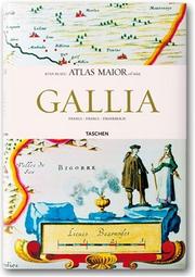
Chef-d'œuvre de la cartographie du siècle baroque, l'Atlas maior a été publié entre 1662 et 1665 par l'éditeur amstellodamois Joan Blaeu, l'un des plus éminents cartographes hollandais. Paru à l'origine en latin, l'atlas comprenait 594 cartes réunies en 11 volumes et montrait la totalité du monde connu à cette époque. Ce livre fut le plus complet et le plus cher du XVIe siècle. Atlas mondial de référence pendant plus d'un siècle, il est devenu très rare aujourd'hui et compte parmi les ouvrages les plus précieux et les plus recherchés. La réimpression par TASCHEN de cet atlas en six volumes est basée sur l'exemplaire colorié et doré à l'or fin de la Bibliothèque nationale d'Autriche à Vienne, ce qui assure la meilleure précision et qualité possibles. Outre les citations originales de Joan Blaeu concernant les différentes cartes, un texte inédit de Peter van der Krogt explique le contexte historique et culturel tout en conduisant le lecteur dans le monde fascinant de la cartographie du début des Temps modernes. Le volume intitulé " Gallia " comprend les 64 cartes de la France accompagnées de textes en français, en anglais et en allemand. "Anglia, Scotia et Hibernia" rassemble les 58 cartes de l'Angleterre, 55 cartes de l'Écosse et de l'Irlande, et des textes en anglais, en français et en allemand. "Germania, Austria et Helvetia" présente les 97 cartes de la Germanie, 20 cartes de l'Autriche et 7 cartes de la Suisse et des textes en allemand, en anglais et en français. Le volume "Italia" comporte les 60 cartes de l'Italie et des textes en italien, en anglais, en allemand. "Belgica Regia et Belgica Foederata" rassemble les 63 cartes de la Belgique et des Pays-Bas et des textes en hollandais, en français et en anglais. Le sixième volume "Hispania, Portugallia, Africa et America" comprend les 28 cartes de l'Espagne et du Portugal, ainsi que 13 cartes de l'Afrique et 23 cartes de l'Amérique : les textes sont en espagnol, en anglais et en portugais."--[Amazon.com]
Book history
---
Geodesy. Cartography
---
Blaeu, Joan I
---
France
---
Atlases, French
---
History.
---
Blaeu, Joan,
---
912 "16"
---
912 <09> <43>
---
912 <09> <436>
---
912 <09> <494>
---
094.2 <436 WIEN>
---
Cartografie. Kaarten. Plattegronden. Atlassen--17e eeuw. Periode 1600-1699
---
Cartografie. Kaarten. Plattegronden. Atlassen--Geschiedenis van ...--Duitsland voor 1945 en na 1989
---
Cartografie. Kaarten. Plattegronden. Atlassen--Geschiedenis van ...--Oostenrijk
---
Cartografie. Kaarten. Plattegronden. Atlassen--Geschiedenis van ...--Zwitserland
---
Oude drukken: bibliotheekcatalogi--
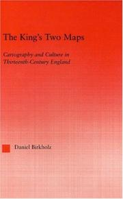
ISBN: 0415967910 9780415967914 0203505425 9780203505427 9786610224098 6610224099 1280224096 9781280224096 1135884951 113588496X 9781135884918 9781135884956 9781135884963 9780415803427 Year: 2004 Volume: 22 Publisher: New York Routledge
Abstract | Keywords | Export | Availability | Bookmark
Loading...Choose an application
- Reference Manager
- EndNote
- RefWorks (Direct export to RefWorks)
This book chronicles the specific technologies, material and epistemological, by which the map - a peculiar artefact, part image and part treatise - shows itself capable of accessing, organizing and reorienting a tremendous range of information.
Cartography --- Cartographie --- History --- Social aspects --- Histoire --- Aspect social --- 912 "04/14" --- 912 <09> <41> --- Cartografie. Kaarten. Plattegronden. Atlassen--Middeleeuwen --- Cartografie. Kaarten. Plattegronden. Atlassen--Geschiedenis van ...--Verenigd Koninkrijk van Groot-Brittannië en Noord-Ierland --- Cartography, Primitive --- Chartography --- Map-making --- Mapmaking --- Mapping (Cartography) --- Mathematical geography --- Surveying --- Map projection --- Maps --- Great Britain
Book
ISBN: 9789004441682 9004441689 9789004441231 9004441239 Year: 2020 Publisher: Leiden ; Boston : Brill,
Abstract | Keywords | Export | Availability | Bookmark
Loading...Choose an application
- Reference Manager
- EndNote
- RefWorks (Direct export to RefWorks)
Mountains appear in the oldest known maps yet their representation has proven a notoriously difficult challenge for map makers. In this essay, Ernesto Capello surveys the broad history of relief representation in cartography with an emphasis on the allegorical, commercial and political uses of mapping mountains. After an initial overview and critique of the traditional historiography and development of techniques of relief representation, the essay features four clusters of mountain mapping emphases. These include visions of mountains as paradise, the mountain as site of colonial and postcolonial encounter, the development of elevation profiles and panoramas, and mountains as mass-marketed touristed itineraries.
912 <09> --- 912 <23> --- History of cartography --- 912 <23> Cartografie. Kaarten. Plattegronden. Atlassen--Gebergten. Bergen. --- Cartografie. Kaarten. Plattegronden. Atlassen--Gebergten. Bergen. --- 912 <23> Cartography. Maps. Atlasses--Mountain Ranges. Mountains --- Cartography. Maps. Atlasses--Mountain Ranges. Mountains --- Cartografie. Kaarten. Plattegronden. Atlassen--Geschiedenis van --- Cartografie. Kaarten. Plattegronden. Atlassen--Gebergten. Bergen --- E-books --- Mountain mapping. --- Cartography.
Book
ISBN: 9780300219166 0300219164 9780300228496 030022849X 0300247761 9780300247763 Year: 2017 Publisher: New Haven
Abstract | Keywords | Export | Availability | Bookmark
Loading...Choose an application
- Reference Manager
- EndNote
- RefWorks (Direct export to RefWorks)
"In the rapidly changing world of the early Middle Ages, depictions of the cosmos represented a consistent point of reference across the three dominant states-the Frankish, Byzantine, and Islamic Empires. As these empires diverged from their Greco-Roman roots between 700 and 1000 A.D. and established distinctive medieval artistic traditions, cosmic imagery created a web of visual continuity, though local meanings of these images varied greatly. Benjamin Anderson uses thrones, tables, mantles, frescoes, and manuscripts to show how cosmological motifs informed relationships between individuals, especially the ruling elite, and communities, demonstrating how domestic and global politics informed the production and reception of these depictions. The first book to consider such imagery across the dramatically diverse cultures of Western Europe, Byzantium, and the Islamic Middle East, [it] illuminates the distinctions between the cosmological art of these three cultural spheres, and reasserts the centrality of astronomical imagery to the study of art history"--Jacket flap.
Art, Medieval --- Cosmology in art --- Art médiéval --- Cosmologie dans l'art --- European influences --- Byzantine influences. --- Islamic influences --- Themes, motives. --- Influence européenne --- Influence byzantine --- Influence islamique --- Thèmes, motifs --- 912 <09> "04/14" --- 091:52 --- 52 <092> --- 52 <092> Astronomie. Astrofysica. Ruimteonderzoek. Geodesie--Biografieën --- 52 <092> Astronomy. Astrophysics. Space research. Geodesy--Biografieën --- Astronomie. Astrofysica. Ruimteonderzoek. Geodesie--Biografieën --- Astronomy. Astrophysics. Space research. Geodesy--Biografieën --- 091:52 Handschriften i.v.m. astronomie-- Zie ook: {091:133.52} --- Handschriften i.v.m. astronomie-- Zie ook: {091:133.52} --- 912 <09> "04/14" Cartografie. Kaarten. Plattegronden. Atlassen--Geschiedenis van ...--Middeleeuwen --- 912 <09> "04/14" Cartography. Maps. Atlasses--Geschiedenis van ...--Middeleeuwen --- Cartografie. Kaarten. Plattegronden. Atlassen--Geschiedenis van ...--Middeleeuwen --- Cartography. Maps. Atlasses--Geschiedenis van ...--Middeleeuwen --- Weltall (Motiv). --- Kunst. --- Astronomie (Motiv). --- Geschichte 500-1100. --- Art médiéval --- Influence européenne --- Thèmes, motifs --- ART / History / Medieval. --- Islamic civilization --- Medieval art --- European influences. --- Islamic influences.
Book

ISBN: 9782868203748 2868203744 9791034404261 Year: 2019 Volume: 15 Publisher: Strasbourg : Presses universitaires de Strasbourg,
Abstract | Keywords | Export | Availability | Bookmark
Loading...Choose an application
- Reference Manager
- EndNote
- RefWorks (Direct export to RefWorks)
Si la production cartographique se diversifie au cours des xviie et xixe siècles, les usages des cartes font de même : usages administratifs, savants, mais aussi démonstratifs, rhétoriques, etc., les uns n'excluant évidemment pas les autres. C'est en traitant de front les opérations techniques de production des cartes et les pratiques de leur consultation que les auteurs de cet ouvrage proposent d'aborder l'histoire de la cartographie. Cette approche pragmatique permet de se démarquer du « paradigme empirique » de l'histoire de la cartographie. Elle souligne qu'une carte offre des images du territoire variables selon la communauté d'usagers à qui elle est destinée.
Cartography --- Map drawing --- Map reading --- Cartographie --- Cartes géographiques --- Lecture de cartes --- History --- Histoire --- Dessin --- Maps --- History 17th century --- History 18th century --- History 19th century --- History 17th century. --- History 18th century. --- History 19th century. --- 912 <063> --- 912 <09> <44> --- Cartography. Maps. Atlasses--Congressen --- Cartografie. Kaarten. Plattegronden. Atlassen--Geschiedenis van ...--Frankrijk --- Cartes géographiques --- Cartography, Primitive --- Chartography --- Map-making --- Mapmaking --- Mapping (Cartography) --- Mathematical geography --- Surveying --- Map projection --- Maps - History - 17th century --- Maps - History - 18th century --- Maps - History - 19th century --- Cartography - History 17th century --- Cartography - History 18th century --- Cartography - History 19th century --- cartographie --- histoire --- histoire contemporaine
| Listing 1 - 10 of 16 | << page >> |
Sort by
|