
 Search
 Feedback
 About
About Help
Help News
News
| Listing 1 - 6 of 6 |
Sort by
|
Book
ISBN: 9080248215 Year: 1996 Publisher: Tilburg European centre for nature conservation
Abstract | Keywords | Export | Availability | Bookmark
 Loading...
Choose an application
- Reference Manager
- EndNote
- RefWorks (Direct export to RefWorks)
Geografie --- Landschapskunde --- Ecologie. --- biodiversity --- ecological factors --- economy --- land use --- landscape dynamics --- monitoring --- nature conservation --- privatization --- rural development --- symposium proceedings --- 631.47 --- 504.54 --- Surveying, classification and utilization of land. Soil profiles. Litter. Humus. Topsoil. Subsoil etc. Micropedology --- Landscape. Landscape ecology --- Conferences - Meetings --- 504.54 Landscape. Landscape ecology --- 631.47 Surveying, classification and utilization of land. Soil profiles. Litter. Humus. Topsoil. Subsoil etc. Micropedology

ISBN: 3534131894 Year: 1996 Publisher: Darmstadt Wissenschaftliche Buchgesellschaft
Abstract | Keywords | Export | Availability | Bookmark
Loading...Choose an application
- Reference Manager
- EndNote
- RefWorks (Direct export to RefWorks)
Rome --- Administrative and political divisions --- Provinces --- Politics and government --- Divisions politiques et administratives --- Politique et gouvernement --- Centuriation (Surveying) --- -Land use --- -Regional planning --- -Regional development --- Regional planning --- State planning --- Human settlements --- Land use --- Planning --- City planning --- Landscape protection --- Land --- Land utilization --- Use of land --- Utilization of land --- Economics --- Land cover --- Landscape assessment --- NIMBY syndrome --- Surveying --- Government policy --- -Centuriation (Surveying) --- Regional development

ISBN: 1857285859 1857285840 0203461452 0203451481 1280067241 1135362831 9780203451489 9780203430903 0203430905 9781857285840 9781857285857 0203430905 9781134810802 9781134810840 9781134810857 9780415120067 9780415120074 9781135362782 9781135362829 9781135362836 1135362823 Year: 1996 Publisher: London ; Bristol, Pa. : UCL Press,
Abstract | Keywords | Export | Availability | Bookmark
Loading...Choose an application
- Reference Manager
- EndNote
- RefWorks (Direct export to RefWorks)
An introduction to development control, a topic of interest to students of planning or urban studies, with a comparative flavour, drawing particularly on the USA, France and Hong Kong.
Land use. --- Land use - Europe - Planning. --- Zoning. --- Land use --- Zoning --- Real Estate, Housing & Land Use --- Business & Economics --- Planning --- City planning --- Districting (City planning) --- Land --- Land utilization --- Use of land --- Utilization of land --- Zone system --- Inclusionary housing programs --- Economics --- Land cover --- Landscape assessment --- NIMBY syndrome
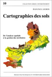
ISBN: 2880742986 9782880742980 Year: 1996 Volume: 10 Publisher: Lausanne : Presses polytechniques et universitaires romandes,
Abstract | Keywords | Export | Availability | Bookmark
Loading...Choose an application
- Reference Manager
- EndNote
- RefWorks (Direct export to RefWorks)
Cartographie --- Cartographie pédologique --- Pédologie --- Sols --- Informatique --- Aménagement --- Soil --- cartography --- Collecte de données --- data collection --- Système d'information géographique --- Geographical information systems --- Application des ordinateurs --- computer applications --- Modèle --- Models --- Méthodologie --- methodology --- Aménagement du territoire --- Land use planning --- Recherche interdisciplinaire --- Interdisciplinary research --- 528.94 --- 631.47 --- 711.142 --- 912:631.4 --- Thematic cartography. Topical cartography --- Surveying, classification and utilization of land. Soil profiles. Litter. Humus. Topsoil. Subsoil etc. Micropedology --- Planologie: grondclassificatie; bodemkartering --- Maps. Atlasses: soils --- Geografie --- Cartografie --- Toepassingen. --- 711.142 Planologie: grondclassificatie; bodemkartering --- 631.47 Surveying, classification and utilization of land. Soil profiles. Litter. Humus. Topsoil. Subsoil etc. Micropedology --- 528.94 Thematic cartography. Topical cartography --- Cartographie pédologique --- Pédologie --- Aménagement --- Soil surveys --- Cartography --- Remote sensing --- Soil surveys - Remote sensing --- Cartographie pédologique - Informatique --- Cartographie des sols
Book
ISBN: 2709913313 Year: 1996 Publisher: Paris : ORSTOM éditions,
Abstract | Keywords | Export | Availability | Bookmark
Loading...Choose an application
- Reference Manager
- EndNote
- RefWorks (Direct export to RefWorks)
631.47 --- 504.53 --- 631.92 --- 528.8 --- 681.3*H4 --- GG Cartography --- 681.3*H4 Information systems applications (GIS etc.) --- Information systems applications (GIS etc.) --- 528.8 Remote sensing. Teledetection --- Remote sensing. Teledetection --- 631.92 Geophysical effects of cultivation. Influence of agriculture on climate, soil, watercourses, erosion, landslips etc. --- Geophysical effects of cultivation. Influence of agriculture on climate, soil, watercourses, erosion, landslips etc. --- 504.53 Earth surface. Soil environment --- Earth surface. Soil environment --- 631.47 Surveying, classification and utilization of land. Soil profiles. Litter. Humus. Topsoil. Subsoil etc. Micropedology --- Surveying, classification and utilization of land. Soil profiles. Litter. Humus. Topsoil. Subsoil etc. Micropedology --- Conferences - Meetings --- Télédétection. --- Systèmes d'information géographique. --- Environnement --- Cartographie de l'environnement. --- Systèmes d'information. --- Système d'information géographique.
ISBN: 1559635142 Year: 1996 Publisher: Cambridge Harvard university. Graduate school of design
Abstract | Keywords | Export | Availability | Bookmark
Loading...Choose an application
- Reference Manager
- EndNote
- RefWorks (Direct export to RefWorks)
Landscape ecology has emerged in the past decade as an important and useful tool for land-use planners and landscape architects. While professionals and scholars have begun to incorporate aspects of this new field into their work, there remains a need for a summary of key principles and how they might be applied in design and planning.This volume fills that need. It is a concise handbook that lists and illustrates key principles in the field, presenting specific examples of how the principles can be applied in a range of scales and diverse types of landscapes around the world.Chapters cover: patches -- size, number, and location edges and boundaries corridors and connectivity mosaics summaries of case studies from around the world
Landscape architecture. --- Landscape ecology. --- Land use --- Architecture du paysage --- Ecologie du paysage --- Utilisation du sol --- Planning. --- Planification --- Landschapsecologie --- 504.54 --- 712 --- 711.14 --- 719 --- -504.54 --- Land --- Land utilization --- Use of land --- Utilization of land --- Economics --- Land cover --- Landscape assessment --- NIMBY syndrome --- Ecology --- Horticultural service industry --- Landscape gardening --- Landscaping industry --- Landscape. Landscape ecology --- Landschapsarchitectuur. Tuinkunst. Parkaanleg --- Planologie: grondvraagstukken; grondhuishouding --- Natuurbescherming. Landschapsbescherming. Heemschut --- Planning --- 504.54 Landscape. Landscape ecology --- 719 Natuurbescherming. Landschapsbescherming. Heemschut --- 711.14 Planologie: grondvraagstukken; grondhuishouding --- 712 Landschapsarchitectuur. Tuinkunst. Parkaanleg --- Landscape architecture --- Landscape ecology --- Government policy
| Listing 1 - 6 of 6 |
Sort by
|