
 Search
 Feedback
 About
About Help
Help News
News
| Listing 1 - 10 of 31 | << page >> |
Sort by
|
Digital
Year: 2005 Publisher: Antwerpen Hogere Zeevaartschool
Abstract | Keywords | Export | Availability | Bookmark
 Loading...
Choose an application
- Reference Manager
- EndNote
- RefWorks (Direct export to RefWorks)
Shipping --- navigatie --- cartografie --- maritieme geschiedenis
Book
Year: 2005 Publisher: Brussel Algemeen Rijksarchief
Abstract | Keywords | Export | Availability | Bookmark
Loading...Choose an application
- Reference Manager
- EndNote
- RefWorks (Direct export to RefWorks)
Christian church history --- Geography --- cartografie --- Hemiksem
Book
ISBN: 1405478985 9781405478984 Year: 2005 Publisher: Bath Parragon books
Abstract | Keywords | Export | Availability | Bookmark
Loading...Choose an application
- Reference Manager
- EndNote
- RefWorks (Direct export to RefWorks)
912 <09> --- 912:930 --- Cartografie. Kaarten. Plattegronden. Atlassen--Geschiedenis van ... --- Cartografie. Kaarten. Plattegronden. Atlassen-:-Geschiedwetenschap. Hulpwetenschappen der geschiedenis --- Cartografie. Kaarten. Plattegronden. Atlassen--Geschiedenis van .. --- Cartografie. Kaarten. Plattegronden. Atlassen--Geschiedenis van . --- Cartografie. Kaarten. Plattegronden. Atlassen--Geschiedenis van
Book
ISBN: 9001968996 Year: 2005 Publisher: Groningen Wolters-Noordhoff
Abstract | Keywords | Export | Availability | Bookmark
Loading...Choose an application
- Reference Manager
- EndNote
- RefWorks (Direct export to RefWorks)
912 --- Cartografie. Kaarten. Plattegronden. Atlassen --- 950.6 --- Atlassen
ISBN: 0297843729 9780297843726 Year: 2005 Publisher: London Weidenfeld and Nicolson
Abstract | Keywords | Export | Availability | Bookmark
Loading...Choose an application
- Reference Manager
- EndNote
- RefWorks (Direct export to RefWorks)
Maps are not just diagrams of the route from A to B - from the earliest times they have helped us make sense of our world, from the very local to the global. Simply organised as a progression through time, each map is not only a beautiful work of art in its own right but also tells us about our changing perception of the earth. Sometimes, of course, maps tell lies and there are examples represented here that are meant to alter or influence our understanding of the world around us. There are maps of oceans and continents charted by heroic adventurers sailing into the unknown, at sea for years in tiny ships. For every example of a beautifully embellished map that has survived there must have been scores of cartographers who perished at sea or in 'unknown parts'. Maps are not just about understanding and representing the physical world: they have an administrative use in demarcating national boundaries or individual plots of land, a social use in showing who lives where, a military use in depicting the layout of enemy positions, a political or propaganda use in showing one country or faction at an advantage over others. All are represented in this book, a history of the world in images from around the globe and from every epoch.
912 <09> --- Cartografie. Kaarten. Plattegronden. Atlassen--Geschiedenis van ... --- Geodesy. Cartography --- cartography [discipline] --- Cartografie. Kaarten. Plattegronden. Atlassen--Geschiedenis van .. --- Cartografie. Kaarten. Plattegronden. Atlassen--Geschiedenis van . --- Cartografie. Kaarten. Plattegronden. Atlassen--Geschiedenis van
Book
Abstract | Keywords | Export | Availability | Bookmark
Loading...Choose an application
- Reference Manager
- EndNote
- RefWorks (Direct export to RefWorks)
ISBN: 085177945X 9780851779454 Year: 2005 Publisher: London Conway Maritime Press
Abstract | Keywords | Export | Availability | Bookmark
Loading...Choose an application
- Reference Manager
- EndNote
- RefWorks (Direct export to RefWorks)
912 <26> --- 912:551.46 --- 912 <09> --- Cartografie. Kaarten. Plattegronden. Atlassen--Oceanen. Zeeën. Zeestraten en zeeverbindingen --- Kaarten. Atlassen: oceanen --- Cartografie. Kaarten. Plattegronden. Atlassen--Geschiedenis van ... --- 912:551.46 Kaarten. Atlassen: oceanen --- Discoveries in geography --- Nautical charts --- History --- Cartografie. Kaarten. Plattegronden. Atlassen--Geschiedenis van .. --- Cartografie. Kaarten. Plattegronden. Atlassen--Geschiedenis van . --- Cartografie. Kaarten. Plattegronden. Atlassen--Geschiedenis van
Book
ISBN: 2951095961 9782951095960 Year: 2005 Publisher: Castelnau-le-Lez Prado
Abstract | Keywords | Export | Availability | Bookmark
Loading...Choose an application
- Reference Manager
- EndNote
- RefWorks (Direct export to RefWorks)
929 MERCATOR, GERARDUS --- 912 "15" --- 912 <09> <493> --- Biografie. Genealogie. Heraldiek--MERCATOR, GERARDUS --- Cartografie. Kaarten. Plattegronden. Atlassen--16e eeuw. Periode 1500-1599 --- Cartografie. Kaarten. Plattegronden. Atlassen--Geschiedenis van ...--België --- 929 MERCATOR, GERARDUS Biografie. Genealogie. Heraldiek--MERCATOR, GERARDUS
Book

ISBN: 9064698074 Year: 2005 Publisher: Alphen aan den Rijn Canaletto/Repro Holland
Abstract | Keywords | Export | Availability | Bookmark
Loading...Choose an application
- Reference Manager
- EndNote
- RefWorks (Direct export to RefWorks)
Book history --- Geodesy. Cartography --- Keulen, van [Family] --- 912 <09> <492> --- 912 <26> --- 912 "16" --- 912 "17" --- 912 "18" --- Cartografie. Kaarten. Plattegronden. Atlassen--Geschiedenis van ...--Nederland --- Cartografie. Kaarten. Plattegronden. Atlassen--Oceanen. Zeeën. Zeestraten en zeeverbindingen --- Cartografie. Kaarten. Plattegronden. Atlassen--17e eeuw. Periode 1600-1699 --- Cartografie. Kaarten. Plattegronden. Atlassen--18e eeuw. Periode 1700-1799 --- Cartografie. Kaarten. Plattegronden. Atlassen--19e eeuw. Periode 1800-1899 --- Cartography --- Manuscript maps --- Maps --- Nautical charts --- Charts, Nautical --- Hydrographic charts --- Inland navigation --- Navigation --- Navigation charts --- Navigation maps --- Pilot charts --- Aids to navigation --- Nautical paraphernalia --- Notices to mariners --- Plans --- Cartographic materials --- Geography --- Maps, Manuscript --- Manuscripts --- Cartography, Primitive --- Chartography --- Map-making --- Mapmaking --- Mapping (Cartography) --- Mathematical geography --- Surveying --- Map projection --- History --- Van Keulen (Firm) --- History.
ISBN: 0226653412 9780226653419 9780226817583 Year: 2005 Volume: *5 Publisher: Chicago University of Chicago Press
Abstract | Keywords | Export | Availability | Bookmark
Loading...Choose an application
- Reference Manager
- EndNote
- RefWorks (Direct export to RefWorks)
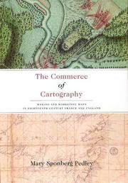
Though the political and intellectual history of mapmaking in the eighteenth century is well established, the details of its commercial revolution have until now been widely scattered. In The Commerce of Cartography, Mary Pedley presents a vivid picture of the costs and profits of the mapmaking industry in England and France, and reveals how the economics of map trade affected the content and appearance of the maps themselves. Conceptualizing the relationship between economics and cartography, Pedley traces the process of mapmaking from compilation, production, and marketing to consumption, reception, and criticism. In detailing the rise of commercial cartography, Pedley explores qualitative issues of mapmaking as well. Why, for instance, did eighteenth-century ideals of aesthetics override the modern values of accuracy and detail? And what, to an eighteenth-century mind and eye, qualified as a good map? A thorough and engaging study of the business of cartography during the Enlightenment, The Commerce of Cartography charts a new cartographic landscape and will prove invaluable to scholars of economic history, historical geography, and the history of publishing.
912 "17" --- 912 <09> <41> --- 912 <09> <44> --- Cartografie. Kaarten. Plattegronden. Atlassen--18e eeuw. Periode 1700-1799 --- Cartografie. Kaarten. Plattegronden. Atlassen--Geschiedenis van ...--Verenigd Koninkrijk van Groot-Brittannië en Noord-Ierland --- Cartografie. Kaarten. Plattegronden. Atlassen--Geschiedenis van ...--Frankrijk --- Cartography --- Map industry and trade --- Map trade --- Manufacturing industries --- Cartography, Primitive --- Chartography --- Map-making --- Mapmaking --- Mapping (Cartography) --- Mathematical geography --- Surveying --- Map projection --- Maps --- History --- 912 <41> --- 912 <44> --- 912:33 --- Cartografie. Kaarten. Plattegronden. Atlassen-:-Handel. --- 912 "17" Cartografie. Kaarten. Plattegronden. Atlassen--18e eeuw. Periode 1700-1799 --- 912 "17" Cartography. Maps. Atlasses--18e eeuw. Periode 1700-1799 --- Cartography. Maps. Atlasses--18e eeuw. Periode 1700-1799 --- 912 <44> Cartografie. Kaarten. Plattegronden. Atlassen--Frankrijk --- 912 <44> Cartography. Maps. Atlasses--Frankrijk --- Cartografie. Kaarten. Plattegronden. Atlassen--Frankrijk --- Cartography. Maps. Atlasses--Frankrijk --- 912 <41> Cartografie. Kaarten. Plattegronden. Atlassen--Verenigd Koninkrijk van Groot-Brittannië en Noord-Ierland --- 912 <41> Cartography. Maps. Atlasses--Verenigd Koninkrijk van Groot-Brittannië en Noord-Ierland --- Cartografie. Kaarten. Plattegronden. Atlassen--Verenigd Koninkrijk van Groot-Brittannië en Noord-Ierland --- Cartography. Maps. Atlasses--Verenigd Koninkrijk van Groot-Brittannië en Noord-Ierland --- Cartografie. Kaarten. Plattegronden. Atlassen-:-Handel
| Listing 1 - 10 of 31 | << page >> |
Sort by
|