| Listing 1 - 10 of 23 | << page >> |
Sort by
|
Book
Year: 1981 Publisher: Paris : S.H.O.M. (Service Hydrographique et Océanographique de la Marine),
Abstract | Keywords | Export | Availability | Bookmark
 Loading...
Choose an application
- Reference Manager
- EndNote
- RefWorks (Direct export to RefWorks)
Oceanographic charts --- Hydrographic charts --- Oceanographic charts --- Hydrographic charts
Book
Year: 1981 Publisher: Paris : France. Service hydrographique de la marine,
Abstract | Keywords | Export | Availability | Bookmark
 Loading...
Choose an application
- Reference Manager
- EndNote
- RefWorks (Direct export to RefWorks)
Oceanographic charts --- Hydrographic charts --- Oceanographic charts --- Hydrographic charts
Book
Year: 1981 Publisher: Paris : France. Service hydrographique de la marine,
Abstract | Keywords | Export | Availability | Bookmark
 Loading...
Choose an application
- Reference Manager
- EndNote
- RefWorks (Direct export to RefWorks)
Oceanographic charts --- Hydrographic charts --- Oceanographic charts --- Hydrographic charts
Book
Year: 1981 Publisher: Paris : France. Service hydrographique de la marine,
Abstract | Keywords | Export | Availability | Bookmark
 Loading...
Choose an application
- Reference Manager
- EndNote
- RefWorks (Direct export to RefWorks)
Oceanographic charts --- Hydrographic charts --- Oceanographic charts --- Hydrographic charts
Book
Year: 1956 Publisher: London : MacGibbon and Kee,
Abstract | Keywords | Export | Availability | Bookmark
 Loading...
Choose an application
- Reference Manager
- EndNote
- RefWorks (Direct export to RefWorks)
Hydrographic charts --- Oceanographic charts --- Navigational charts --- Hydrographic charts --- Oceanographic charts --- Navigational charts

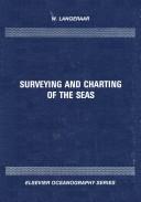
ISBN: 0444422781 9786611756130 128175613X 0080870759 9780444422781 9780080870755 Year: 1984 Publisher: Amsterdam : Elsevier,
Abstract | Keywords | Export | Availability | Bookmark
 Loading...
Choose an application
- Reference Manager
- EndNote
- RefWorks (Direct export to RefWorks)
A practical book for those engaged in marine surveying and charting activities who must acquire, process and present data for hydrographic or engineering purposes. It covers the latest instrumental and equipment development, automation and computerization, as well as conventional methods for those without access to sophisticated instrumentation.
Issue --- Cartography. --- Nautical charts. --- Charts, Nautical --- Hydrographic charts --- Inland navigation --- Navigation --- Navigation charts --- Navigation maps --- Pilot charts --- Aids to navigation --- Maps --- Nautical paraphernalia --- Notices to mariners --- Cartography, Primitive --- Chartography --- Map-making --- Mapmaking --- Mapping (Cartography) --- Mathematical geography --- Surveying --- Map projection

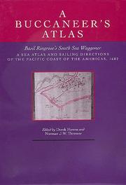
ISBN: 0520054105 058521316X Year: 1992 Publisher: Berkeley : University of California Press,
Abstract | Keywords | Export | Availability | Bookmark
 Loading...
Choose an application
- Reference Manager
- EndNote
- RefWorks (Direct export to RefWorks)
Nautical charts --- Pilot guides --- Geography --- Earth & Environmental Sciences --- Atlases & Maps --- Early works to 1800 --- Facsimiles. --- Charts, Nautical --- Hydrographic charts --- Inland navigation --- Navigation --- Navigation charts --- Navigation maps --- Pilot charts --- Coast-pilot guides --- Aids to navigation --- Maps --- Nautical paraphernalia --- Notices to mariners --- Pilots and pilotage --- Air-pilot guides

ISBN: 080186660X 0801875471 9780801875472 9780801866609 Year: 2000 Publisher: Baltimore Johns Hopkins University Press
Abstract | Keywords | Export | Availability | Bookmark
 Loading...
Choose an application
- Reference Manager
- EndNote
- RefWorks (Direct export to RefWorks)
Nautical charts --- -Vikings --- -Northmen --- Charts, Nautical --- Hydrographic charts --- Navigation charts --- Navigation maps --- Pilot charts --- Aids to navigation --- Nautical paraphernalia --- -Norse. --- Northmen --- History of North America --- Science --- anno 500-1499 --- Early maps --- Geography, Medieval --- Historical geography --- Vikings --- Maps, Early --- Geography --- Atlases, Historical --- Historical atlases --- Historical maps --- Middle Ages --- History --- America --- Discovery and exploration --- Norse. --- Norse --- North America --- Cartes --- Early maps. --- History.
Book
ISBN: 9780773538153 Year: 2011 Publisher: Montréal McGill-Queen's University Press
Abstract | Keywords | Export | Availability | Bookmark
 Loading...
Choose an application
- Reference Manager
- EndNote
- RefWorks (Direct export to RefWorks)
Cartographers --- Nautical charts --- 912 <09> <71> --- Charts, Nautical --- Hydrographic charts --- Inland navigation --- Navigation --- Navigation charts --- Navigation maps --- Pilot charts --- Aids to navigation --- Maps --- Nautical paraphernalia --- Notices to mariners --- Mapmakers --- Earth scientists --- Cartografie. Kaarten. Plattegronden. Atlassen--Geschiedenis van ...--Canada --- Des Barres, Joseph F. W. --- Holland, Samuel, --- Holland, Samuel Johannes, --- Atlantic Coast (North America) --- East Coast (North America) --- Eastern Coast (North America)
Book
ISBN: 1469640457 1469640465 9781469640464 9781469640457 9781469640440 1469640449 9798890847881 Year: 2018 Publisher: Chapel Hill
Abstract | Keywords | Export | Availability | Bookmark
 Loading...
Choose an application
- Reference Manager
- EndNote
- RefWorks (Direct export to RefWorks)
"As the United States grew into an empire in the late nineteenth century, notions like 'sea power' derived not only from fleets, bases, and decisive battles, but also from a scientific effort to understand and master the ocean environment. Beginning in the early nineteenth century and concluding in the first years of the twentieth, Jason W. Smith tells the story of the rise of the U.S. Navy and the emergence of American ocean empire through its struggle to control nature. In vividly told sketches of exploration, naval officers, war, and, most significantly, the ocean environment, Smith draws together insights from environmental, maritime, military, and naval history, and the history of science and cartography, placing the U.S. Navy's scientific efforts within a broader cultural context"--
Imperialism and science. --- Cartography. --- Nautical charts --- Charts, Nautical --- Hydrographic charts --- Inland navigation --- Navigation --- Navigation charts --- Navigation maps --- Pilot charts --- Aids to navigation --- Maps --- Nautical paraphernalia --- Notices to mariners --- Cartography, Primitive --- Chartography --- Map-making --- Mapmaking --- Mapping (Cartography) --- Mathematical geography --- Surveying --- Map projection --- Science and imperialism --- Science --- History. --- United States. --- U.S. Navy --- United States --- History, Naval.
| Listing 1 - 10 of 23 | << page >> |
Sort by
|

 Search
 Feedback
 About UniCat
  Help
Help News
News