
 Search
 Feedback
 About
About Help
Help News
News
| Listing 1 - 6 of 6 |
Sort by
|
Book
ISBN: 3319252445 3319252429 Year: 2016 Publisher: Cham : Springer International Publishing : Imprint: Springer,
Abstract | Keywords | Export | Availability | Bookmark
 Loading...
Choose an application
- Reference Manager
- EndNote
- RefWorks (Direct export to RefWorks)
This volume gathers 19 papers first presented at the 5th International Symposium of the ICA Commission on the History of Cartography, which took place at the University of Ghent, Belgium on 2-5 December 2014. The overall conference theme was 'Cartography in Times of War and Peace', but preference was given to papers dealing with the military cartography of the First World War (1914-1918). The papers are classified by period and regional sub-theme, i.e. Military Cartography from the 18th to the 20th century; WW I Cartography in Belgium, Central Europe, etc.
Military topography --- Military maps --- Maps, Military --- Maps --- Military surveying --- Surveying, Military --- Topography, Military --- Cartography --- Military geography --- Topographical surveying --- Military reconnaissance --- Geographical information systems. --- Geographical Information Systems/Cartography. --- Geographical information systems --- GIS (Information systems) --- Information storage and retrieval systems --- Geography
ISBN: 0292706596 0292796773 Year: 2005 Publisher: Austin : University of Texas Press,
Abstract | Keywords | Export | Availability | Bookmark
Loading...Choose an application
- Reference Manager
- EndNote
- RefWorks (Direct export to RefWorks)
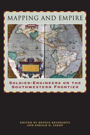
From the sixteenth through the mid-nineteenth centuries, Spain, then Mexico, and finally the United States took ownership of the land from the Gulf Coast of Texas and Mexico to the Pacific Coast of Alta and Baja California—today's American Southwest. Each country faced the challenge of holding on to territory that was poorly known and sparsely settled, and each responded by sending out military mapping expeditions to set boundaries and chart topographical features. All three countries recognized that turning terra incognita into clearly delineated political units was a key step in empire building, as vital to their national interest as the activities of the missionaries, civilian officials, settlers, and adventurers who followed in the footsteps of the soldier-engineers. With essays by eight leading historians, this book offers the most current and comprehensive overview of the processes by which Spanish, Mexican, and U.S. soldier-engineers mapped the southwestern frontier, as well as the local and even geopolitical consequences of their mapping. Three essays focus on Spanish efforts to map the Gulf and Pacific Coasts, to chart the inland Southwest, and to define and defend its boundaries against English, French, Russian, and American incursions. Subsequent essays investigate the role that mapping played both in Mexico's attempts to maintain control of its northern territory and in the United States' push to expand its political boundary to the Pacific Ocean. The concluding essay draws connections between mapping in the Southwest and the geopolitical history of the Americas and Europe.
Military topography --- Military maps --- Maps, Military --- Maps --- Military surveying --- Surveying, Military --- Topography, Military --- Cartography --- Military geography --- Topographical surveying --- Military reconnaissance --- History. --- Southwestern States --- Southwestern United States --- United States, Southwestern --- Discovery and exploration.
Book
ISBN: 1399505807 1399505815 1399505785 Year: 2023 Publisher: Edinburgh : Edinburgh University Press,
Abstract | Keywords | Export | Availability | Bookmark
Loading...Choose an application
- Reference Manager
- EndNote
- RefWorks (Direct export to RefWorks)
William Roy was a polymath and a visionary. His work established the path that would lead to the formation of the Ordnance Survey and to all of the paper-based and digital mapping products that we use today. His story - very much one of the Enlightenment - demonstrates how one man's curiosity and diligence enabled him to excel across a diverse range of topics: military reconnaissance and intelligence; the lessons that could be learned from the past about the tactical use of landscape; the science of determining the height of mountains; and the development of a meticulous methodology to achieve an unprecedented accuracy in topographical measurement. In this biography, Humphrey Welfare uncovers the career and activities of this important figure, and in doing so paints a vivid picture of the inner complexities of 18th-century Britain.
Military engineers --- Engineers --- Roy, William, --- Military engineers. --- Military topography. --- Great Britain --- History. --- Military surveying --- Surveying, Military --- Topography, Military --- Cartography --- Military geography --- Topographical surveying --- Military maps --- Military reconnaissance --- England --- History --- Military topography --- Surveyors
Book
ISBN: 2902559399 9782902559398 Year: 2003 Publisher: Paris: Musée des Plans-Reliefs,
Abstract | Keywords | Export | Availability | Bookmark
Loading...Choose an application
- Reference Manager
- EndNote
- RefWorks (Direct export to RefWorks)
Military geography --- Maps, Military --- Fortification --- Military topography --- 912 <09> --- 091:912 --- 725.18 --- Cartography. Maps. Atlasses--Geschiedenis van ... --- Handschriftenkunde. Handschriftencatalogi-:-Cartografie. Kaarten. Plattegronden. Atlassen --- Militaire bouwkunst --- Conferences - Meetings --- 725.18 Militaire bouwkunst --- 091:912 Handschriftenkunde. Handschriftencatalogi-:-Cartografie. Kaarten. Plattegronden. Atlassen --- Military maps --- Military surveying --- Surveying, Military --- Topography, Military --- Cartography --- Topographical surveying --- Military reconnaissance --- Maps --- Geography, Military --- Terrain study (Military science) --- Geography --- Military art and science --- Fortification, Primitive --- Forts --- Military engineering --- Siege warfare --- Cartography. Maps. Atlasses--Geschiedenis van .. --- Cartography. Maps. Atlasses--Geschiedenis van . --- Cartography. Maps. Atlasses--Geschiedenis van --- Military geography - Congresses. --- Maps, Military - Congresses. --- Fortification - Congresses. --- Military topography - Congresses.
Book
ISBN: 9782746730663 2746730669 Year: 2012 Publisher: Paris : Autrement,
Abstract | Keywords | Export | Availability | Bookmark
Loading...Choose an application
- Reference Manager
- EndNote
- RefWorks (Direct export to RefWorks)
La fascination pour les cartes tend à faire oublier le travail qui précède la production de ces images si particulières. Elles sont pourtant le fruit de multiples opérations savantes et politiques : relevés de terrain, collecte de données, choix d’échelle, de signes, de couleurs, d’impressions. Cet ouvrage aborde l’histoire de la cartographie du XVe au XXIe siècle par le biais non pas des productions elles-mêmes, mais des auteurs de ces cartes. Qui les commande, les conçoit, les dessine, les signe ? Qui est le cartographe ? Quelle est sa place dans la société, quelles sont ses relations avec les détenteurs du pouvoir ? Sans préjuger de l’unité d’un métier de cartographe, l’ouvrage essaye de cerner les diverses figures, les constantes et les évolutions de cette activité dans l’Europe moderne et contemporaine. Pourquoi et comment mathématiciens et astronomes, marins et hydrographes, humanistes, topographes, explorateurs, militaires, artistes, ingénieurs et informaticiens dressent des cartes. Producteurs d’un savoir spatialisé, ils donnent à voir un monde qui est une construction. Et cette construction se comprend d’autant mieux que l’on parvient à en connaître les auteurs.
Technique de représentation --- Topographie --- Cartographie --- Histoire --- Cartography --- Military topography --- Cartography in art --- Art, European --- History --- Themes, motives --- Military surveying --- Surveying, Military --- Topography, Military --- Cartography, Primitive --- Chartography --- Map-making --- Mapmaking --- Mapping (Cartography) --- Maps --- 16th-21st century --- Biographies --- 912 <09> --- 912:623.64 --- 912:35 --- 912:551.46 --- 912:551.46 Kaarten. Atlassen: oceanen --- Kaarten. Atlassen: oceanen --- Cartografie. Kaarten. Plattegronden. Atlassen-:-Administratief recht en openbaar bestuur. --- Cartografie. Kaarten. Plattegronden. Atlassen: Militaire topografie, cartografie, en landmeetkunde. --- 912 <09> Cartografie. Kaarten. Plattegronden. Atlassen--Geschiedenis van ... --- 912 <09> Cartography. Maps. Atlasses--Geschiedenis van ... --- Cartografie. Kaarten. Plattegronden. Atlassen--Geschiedenis van ... --- Cartography. Maps. Atlasses--Geschiedenis van ... --- Cartografie. Kaarten. Plattegronden. Atlassen--Geschiedenis van . --- Cartografie. Kaarten. Plattegronden. Atlassen: Militaire topografie, cartografie, en landmeetkunde --- Cartografie. Kaarten. Plattegronden. Atlassen-:-Administratief recht en openbaar bestuur --- Military geography --- Topographical surveying --- Military maps --- Military reconnaissance --- Mathematical geography --- Surveying --- Map projection --- Cartografie. Kaarten. Plattegronden. Atlassen--Geschiedenis van --- Cartografie. Kaarten. Plattegronden. Atlassen--Geschiedenis van .. --- Cartography - History --- Cartography - France - History --- Military topography - History --- Art, European - Themes, motives
Book
ISBN: 2870510055 9782870510056 Year: 1984 Volume: 19 19 Publisher: Bruxelles : Musée royal de l'armée,
Abstract | Keywords | Export | Availability | Bookmark
Loading...Choose an application
- Reference Manager
- EndNote
- RefWorks (Direct export to RefWorks)
Geodesy. Cartography --- anno 1700-1799 --- Liege --- Armée --- Belgique --- België --- Cartografie --- Cartographie --- Geschiedenis van de nieuwe tijden --- Histoire des temps modernes --- Leger --- Nederland --- Pays-Bas --- Military topography --- -Cartography --- -History --- History --- 623.64 --- 912 <09> <493> --- 912 "17" --- -623 --- Cartography, Primitive --- Chartography --- Map-making --- Mapmaking --- Mapping (Cartography) --- Mathematical geography --- Surveying --- Map projection --- Maps --- Military surveying --- Surveying, Military --- Topography, Military --- Cartography --- Military geography --- Topographical surveying --- Military maps --- Military reconnaissance --- Militaire topografie en cartografie --- Cartografie. Kaarten. Plattegronden. Atlassen--Geschiedenis van ...--België --- Cartografie. Kaarten. Plattegronden. Atlassen--18e eeuw. Periode 1700-1799 --- Militaire technieken --- Geografie --- History. --- Historische Cartografie. --- 623 --- Belgium --- Cartografie. Luik (Prinsbisdom). 17e-18e eeuw. --- Nederlanden (Zuidelijke). Kaarten. 17e-18e eeuw. --- Luik (Prinsbisdom). Kaarten. 17e-18e eeuw. --- Cartographie. Pays-Bas anciens méridionaux. 17e-18e s. --- Cartographie. Liège (Principauté). 17e-18e s. --- Pays-Bas anciens méridionaux. Cartes. 17e-18e s. --- Liège (Principauté). Cartes. 17e-18e s. --- Cartografie. Nederlanden (Zuidelijke). 17e-18e eeuw. --- Military topography - - History - Belgium --- -Cartography - - History - Belgium --- cartografie --- Liege, principaute de --- Pays-bas meridionaux --- Pays-bas --- 17e-18e siecles --- Liege (principaute) --- Cartes et plans --- Cartes historiques
| Listing 1 - 6 of 6 |
Sort by
|