
 Search
 Feedback
 About
About Help
Help News
News
| Listing 1 - 8 of 8 |
Sort by
|
Map
Abstract | Keywords | Export | Availability | Bookmark
 Loading...
Choose an application
- Reference Manager
- EndNote
- RefWorks (Direct export to RefWorks)
Agricultural instruments. --- Angels and putti. --- Animals. --- Farmers. --- Food. --- Fortifications. --- Professions.
Map
Abstract | Keywords | Export | Availability | Bookmark
Loading...Choose an application
- Reference Manager
- EndNote
- RefWorks (Direct export to RefWorks)
Musicians. --- Nautical instruments. --- Weapons. --- Windmills --- Angels and putti. --- Animals. --- Food. --- Fortifications. --- Heraldry. --- History --- Mills. --- Weaponry.
Map
Year: 1901 Publisher: S.l. : s.n.,
Abstract | Keywords | Export | Availability | Bookmark
Loading...Choose an application
- Reference Manager
- EndNote
- RefWorks (Direct export to RefWorks)
17. Plano (37,5 x 44 cm) met een kaart van Nederland met daarop aangeduid de steden waar in de zestiende eeuw Rederijkerskamers actief waren. Bovenaan dan ook de titel "Rederijkerskamers in Noord-Nederland, XVIe eeuw". Vgl. de uitslaande plaat tegenover p. 24 van de door A. van Elslander samengestelde 'Lijst van Noord-Nederlandsche Rederijkerskamers uit de XVe en XVIe eeuw' in 'Jaarboek De Fontaine, 1945'.
Angels and putti. --- Boats, ships and harbours. --- Heraldry. --- Mythology. --- Nautical instruments.
Map
Publisher: S.l. : s.n.,
Abstract | Keywords | Export | Availability | Bookmark
Loading...Choose an application
- Reference Manager
- EndNote
- RefWorks (Direct export to RefWorks)
17. Plano (37,5 x 44 cm) met een kaart van Nederland met daarop aangeduid de steden waar in de zestiende eeuw Rederijkerskamers actief waren. Bovenaan dan ook de titel "Rederijkerskamers in Noord-Nederland, XVIe eeuw". Vgl. de uitslaande plaat tegenover p. 24 van de door A. van Elslander samengestelde 'Lijst van Noord-Nederlandsche Rederijkerskamers uit de XVe en XVIe eeuw' in 'Jaarboek De Fontaine, 1945'.
Angels and putti. --- Boats, ships and harbours. --- Heraldry. --- Mythology. --- Nautical instruments.
ISBN: 1280461918 9786610461912 1846282365 1852337494 1849969035 Year: 2005 Publisher: London : Springer London : Imprint: Springer,
Abstract | Keywords | Export | Availability | Bookmark
Loading...Choose an application
- Reference Manager
- EndNote
- RefWorks (Direct export to RefWorks)
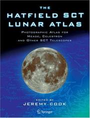
SCT and Maksutov telescopes - which of course includes the best-selling models from Meade, Celestron, and other important manufacturers - reverse the visual image left for right, giving a "mirror image". This makes it extremely difficult to identify lunar features at the eyepiece of one of these instruments using conventional atlases, which show the Moon "upside-down" with south at the top. This new SCT version of Hatfield's famous lunar atlas solves the problem. Photographs and key maps in the Hatfield SCT Lunar Atlas are exactly as the Moon appears through the eyepiece of an SCT or Maksutov telescope. Smaller IAU-standard reference photographs are included on each page, to make it simple to compare the mirrored SCT photographs and maps with those that appear in other atlases. This edition uses the superb original photographs taken by Commander Henry Hatfield using his purpose-built 12-inch reflector. The key maps, on which lunar features can be readily identified, retain the style and clarity that made the original justly famous.
Lunar geology. --- Moon --- Earth (Planet) --- Satellite --- Astrogeology --- Astronomy. --- Popular Science in Astronomy. --- Astronomy, Observations and Techniques. --- Observations, Astronomical. --- Astronomy—Observations. --- Astronomical observations --- Observations, Astronomical --- SCIENCE / Space Science / Astronomy. --- JUVENILE NONFICTION / Science & Nature / Astronomy. --- Astronomy, Observations and Techniques --- Planetology. --- Lunar craters --- Telescopes --- Astronomy --- Observations. --- Astronomical telescopes --- Optical telescopes --- Telescope --- Astronomical instruments --- Optical instruments --- Craters, Lunar --- Impact craters, Lunar --- Lunar impact craters --- Moon craters --- Impact craters --- Planetary sciences --- Planetology
Map
ISBN: 1493901672 1461454980 1461454999 1283934159 Year: 2012 Publisher: New York, NY : Springer New York : Imprint: Springer,
Abstract | Keywords | Export | Availability | Bookmark
Loading...Choose an application
- Reference Manager
- EndNote
- RefWorks (Direct export to RefWorks)
The Hatfield Lunar Atlas has become an amateur lunar observer's bible since it was first published in 1968. A major update of the atlas was made in 1998, using the same wonderful photographs that Commander Henry Hatfield made with his purpose-built 12-inch (300 mm) telescope, but bringing the lunar nomenclature up to date and changing the units from Imperial to S.I. metric. However, with modern telescope optics, digital imaging equipment and computer enhancement new pictures can easily surpass what was achieved with Henry Hatfield's 12-inch telescope and a film camera. This limits the usefulness of the original atlas to visual observing or imaging with rather small amateur telescopes. The new, digitally re-mastered edition vastly improves the clarity and definition of the original photographs - significantly beyond the resolution limits of the photographic grains present in earlier atlas versions - while preserving the layout and style of the original publications. This has been achieved by merging computer-visualized Earth-based views of the lunar surface, derived from NASA's Lunar Reconnaissance Orbiter data, with scanned copies of Commander Hatfield's photographic plates, using the author's own software. The result is a The Hatfield Lunar Atlas for twenty-first century amateur telescopes.
Moon -- Atlases. --- Moon -- Maps. --- Moon -- Observations. --- Moon. --- Astronomy & Astrophysics --- Physical Sciences & Mathematics --- Astronomy - General --- Moon --- Physics. --- Planetology. --- Observations, Astronomical. --- Astronomy --- Astronomy. --- Astronomy, Observations and Techniques. --- Popular Science in Astronomy. --- Observations. --- Planetary sciences --- Planetology --- Astronomy—Observations. --- Astronomical observations --- Observations, Astronomical --- Lunar craters --- Physics --- Telescopes --- SCIENCE / Space Science / Astronomy --- JUVENILE NONFICTION / Science & Nature / Astronomy --- Natural philosophy --- Philosophy, Natural --- Physical sciences --- Dynamics --- Astronomical telescopes --- Optical telescopes --- Telescope --- Astronomical instruments --- Optical instruments --- Craters, Lunar --- Impact craters, Lunar --- Lunar impact craters --- Moon craters --- Impact craters
Map
ISBN: 1461486386 1461486394 Year: 2014 Publisher: New York, NY : Springer New York : Imprint: Springer,
Abstract | Keywords | Export | Availability | Bookmark
Loading...Choose an application
- Reference Manager
- EndNote
- RefWorks (Direct export to RefWorks)
In a major publishing event for lunar observers, the justly famous Hatfield atlas is updated in even more usable form. This version of Hatfield’s classic atlas solves the problem of mirror images, making identification of left-right reversed imaged lunar features both quick and easy. SCT and Maksutov telescopes – which of course include the best-selling models from Meade and Celestron – reverse the visual image left to right. Thus it is extremely difficult to identify lunar features at the eyepiece of one of the instruments using a conventional Moon atlas, as the human brain does not cope well when trying to compare the real thing with a map that is a mirror image of it. Now this issue has at last been solved. In this atlas the Moon’s surface is shown at various sun angles, and inset keys show the effects of optical librations. Smaller non-mirrored reference images are also included to make it simple to compare the mirrored SCT plates and maps with those that appear in other atlases. This edition still uses the original photographs taken by Commander Henry Hatfield using his 12-inch reflector, but they have been digitally re-mastered to reveal significantly more lunar surface detail. The key maps, on which lunar features can be readily identified, have been reversed and updated but retain the style and clarity that made the original a standard bearer in the field. A new chapter on modern lunar observing techniques has been added to show amateur astronomers just how many interesting lunar observing projects they can still participate in. Computer-generated sunrise and sunset visualizations of many interesting selected areas have been included, to encourage astronomers to study and learn about the topographic appearance of the lunar surface near the morning and evening terminators. This welcome second edition brings a trove of new resources while still retaining the comprehensive appeal of the original.
Lunar craters. --- Telescopes. --- Astronomical telescopes --- Optical telescopes --- Telescope --- Craters, Lunar --- Impact craters, Lunar --- Lunar impact craters --- Moon craters --- Moon -- Maps. --- Physics. --- Planetology. --- Observations, Astronomical. --- Astronomy --- Astronomy. --- Astronomy, Observations and Techniques. --- Popular Science in Astronomy. --- Observations. --- Astronomical instruments --- Optical instruments --- Impact craters --- Planetary sciences --- Planetology --- Astronomy—Observations. --- Astronomical observations --- Observations, Astronomical --- Moon --- Moon. --- SCIENCE / Space Science / Astronomy --- JUVENILE NONFICTION / Science & Nature / Astronomy --- Astronomy, Observations and Techniques --- Lunar craters --- Telescopes --- Earth (Planet) --- Satellite
Multi
ISBN: 9789004530904 9789004382039 Year: 2022 Publisher: Leiden ; Boston : Brill,
Abstract | Keywords | Export | Availability | Bookmark
Loading...Choose an application
- Reference Manager
- EndNote
- RefWorks (Direct export to RefWorks)
"The first European map of China faintly relied on the copy of a Chinese original, obtained through bribing and espionage; the last covered in this book was the result of the largest land survey ever made until that time. These two and another 125 maps depict, sometimes uniquely, sometimes copying each other, a country whose images were so different that it was hard to understand which to trust. This study reproduces and describes, for the first time, all the maps of China printed in Europe between 1584 and 1735, unravelling the origin of each individual map, their different printing, issues and publication dates. It also tells, for each, the unique story that made possible these visions from another world, stories marked by scholarly breakthroughs, obsession, missionary zeal, commercial sagacity and greed. China on Copper Plates: The First 150 Years of Chinese Maps in Western Prints (1584-1735) For a presentation from the author related to the publication, see: https://repository.hkust.edu.hk/ir/Record/1783.1-117848 . A summary: On June 23, 2022, the fourth session of the academic lecture series on "The Weavers of Four-Dimensional Space-Time and Their Creation" on the History of Maps was held in the form of an online seminar at the Kuang-Chi International Scholars Center. Dr. Marco Caboara, an Italian scholar from the Lee Shau Kee Library of Hong Kong University of Science and Technology, gave a lively presentation entitled "China on Copperplate - the First 150 Years of Western Printed Maps of China, 1584-1735". The lecture was conducted in both Chinese and English. Associate Professor Lin Hong from the School of Humanities of Shanghai Normal University served as the moderator and translator. Dr. Yang Xunling, Deputy Director of the Library of Macau University of Science and Technology, served as the main responder. Professor Huang Yijun of Minzu University of China, and Deputy Youth Associate of Fudan University Researcher Ding Yannan, Dr. Catarina Batista and Dr. Ângela Gil from the Library of Macau University of Science and Technology, and Dr. Zheng Man from the Free University of Berlin participated in the discussion. Many domestic and foreign scholars and map enthusiasts listened to the lecture online. The lecture lasted nearly three hours"--
Suo na. --- China --- Chi na --- Hiang te --- La pa --- So la --- So na --- Sona --- Su-na --- Suona --- Ta ti --- Wa wa erh --- Wu li wa --- Musical instruments --- Oboe --- Tʻaepʻyŏngso --- Cina --- Kinë --- Cathay --- Chinese National Government --- Chung-kuo kuo min cheng fu --- Republic of China (1912-1949) --- Kuo min cheng fu (China : 1912-1949) --- Chung-hua min kuo (1912-1949) --- Kina (China) --- National Government (1912-1949) --- China (Republic : 1912-1949) --- People's Republic of China --- Chinese People's Republic --- Chung-hua jen min kung ho kuo --- Central People's Government of Communist China --- Chung yang jen min cheng fu --- Chung-hua chung yang jen min kung ho kuo --- Central Government of the People's Republic of China --- Zhonghua Renmin Gongheguo --- Zhong hua ren min gong he guo --- Kitaĭskai︠a︡ Narodnai︠a︡ Respublika --- Činská lidová republika --- RRT --- Republik Rakjat Tiongkok --- KNR --- Kytaĭsʹka Narodna Respublika --- Jumhūriyat al-Ṣīn al-Shaʻbīyah --- RRC --- Kitaĭ --- Kínai Népköztársaság --- Chūka Jinmin Kyōwakoku --- Erets Sin --- Sin --- Sāthāranarat Prachāchon Čhīn --- P.R. China --- PR China --- PRC --- P.R.C. --- Chung-kuo --- Zhongguo --- Zhonghuaminguo (1912-1949) --- Zhong guo --- Chine --- République Populaire de Chine --- República Popular China --- Catay --- VR China --- VRChina --- 中國 --- 中国 --- 中华人民共和国 --- Jhongguó --- Bu̇gu̇de Nayiramdaxu Dundadu Arad Ulus --- Bu̇gu̇de Nayiramdaqu Dumdadu Arad Ulus --- Bu̇gd Naĭramdakh Dundad Ard Uls --- BNKhAU --- БНХАУ --- Khi︠a︡tad --- Kitad --- Dumdadu Ulus --- Dumdad Uls --- Думдад Улс --- Kitajska --- China (Republic : 1949- ) --- Suo na --- Geodesy. Cartography --- anno 1500-1599 --- anno 1600-1699 --- anno 1700-1799
| Listing 1 - 8 of 8 |
Sort by
|