| Listing 1 - 10 of 28 | << page >> |
Sort by
|
Book
ISBN: 071230441X Year: 1996 Publisher: London Hereford The British Library Hereford Cathedral
Abstract | Keywords | Export | Availability | Bookmark
 Loading...
Choose an application
- Reference Manager
- EndNote
- RefWorks (Direct export to RefWorks)
World maps --- Early works to 1800 --- Facsimiles --- Geography [Medieval ] --- England --- History
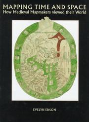
ISBN: 0712345353 Year: 1997 Volume: Volume 1 Publisher: London : British Library,
Abstract | Keywords | Export | Availability | Bookmark
 Loading...
Choose an application
- Reference Manager
- EndNote
- RefWorks (Direct export to RefWorks)
Geodesy. Cartography --- anno 500-1499 --- 912 "04/14" --- Cartography --- -Geography, Medieval --- -528.9 --- Geography --- Medieval geography --- Cartography, Primitive --- Chartography --- Map-making --- Mapmaking --- Mapping (Cartography) --- Mathematical geography --- Surveying --- Map projection --- Maps --- Cartografie. Kaarten. Plattegronden. Atlassen--Middeleeuwen --- History --- Cartography. Mapping (textual documents) --- 528.9 Cartography. Mapping (textual documents) --- Geography, Medieval --- 528.9 --- Atlases, Historical --- Historical atlases --- Middle Ages --- Geography [Medieval ] --- Cartes --- CARTES GEOGRAPHIQUES --- HISTOIRE --- CARTOGRAPHIE MEDIEVALE
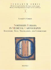
ISBN: 2503514723 9782503514727 Year: 2006 Volume: 4 Publisher: Turnhout Brepols
Abstract | Keywords | Export | Availability | Bookmark
 Loading...
Choose an application
- Reference Manager
- EndNote
- RefWorks (Direct export to RefWorks)
The territory discussed in this book represents the farthest northern and northeast regions of the world known to ancient and medieval geographers and corresponds to modern-day Scandinavia, Russia, Eastern Europe, and countries east of the Caspian Sea. They figured prominently in cartography of the Middle Ages. The mythical island of Scandza, the land of the Amazons, the apocalyptic tribes of Gog and Magog, and other traditional symbols of chaos and barbarity existed side by side and often merged with new knowledge about people, cities, and states. Originally published in Russian, this book offers an analysis of 198 western European and Byzantine maps that date between the eighth and thirteenth centuries and contain information about het north and northeast of the known world.
Geodesy. Cartography --- anno 500-1499 --- Geography, Medieval --- Cartography --- Géographie médiévale --- Cartographie --- History --- Histoire --- Eurasia --- Eurasie --- Maps --- Cartes --- Early maps. --- History. --- Europe, Eastern --- Geography, Medieval. --- 912 "04/14" --- 912 <09> <4-11> --- 912 <09> <4-17> --- Cartografie. Kaarten. Plattegronden. Atlassen--Middeleeuwen --- Cartografie. Kaarten. Plattegronden. Atlassen--Geschiedenis van ...--Oost-Europa --- Cartografie. Kaarten. Plattegronden. Atlassen--Geschiedenis van ...--Noord-Europa --- Géographie médiévale --- Early maps --- Atlases, Historical --- Historical atlases --- Middle Ages --- Geography --- Medieval geography --- Maps, Early --- East Europe --- Eastern Europe --- Cartography - History. --- Geography, Medieval - History. --- Geography, Medieval - Maps. --- Cartography - History --- Geography, Medieval - Maps --- Europe, Eastern - Maps
Book
ISBN: 902745289X 9789027452894 Year: 1975 Volume: 543 Publisher: Utrecht : Het Spectrum,
Abstract | Keywords | Export | Availability | Bookmark
 Loading...
Choose an application
- Reference Manager
- EndNote
- RefWorks (Direct export to RefWorks)
925 --- Cultuurgeschiedenis --- Dagelijks leven --- Middeleeuwen --- History of civilization --- anno 500-1499 --- Europe --- Middeleeuwen ; cultuurgeschiedenis --- Middeleeuwen ; sociaal leven --- Civilization, Medieval. --- Marginality, Social --- Geography, Medieval. --- Occupations --- History --- History. --- Social conditions
Multi
ISBN: 0521085632 0521291267 1139105221 1139163558 9780521085632 9781139163552 Year: 1976 Publisher: Cambridge : Cambridge University Press,
Abstract | Keywords | Export | Availability | Bookmark
 Loading...
Choose an application
- Reference Manager
- EndNote
- RefWorks (Direct export to RefWorks)
Every age has its own geography, separate and distinct from the geographies of earlier and succeeding ages. This 1973 book seeks to examine the complex of natural and man-made features which have provided the background of history, influencing its course and themselves modified by human action. Professor Pounds examines five short periods, each of which is not only relatively well documented, but also important in the climax of a civilisation. In a sense, each represents the climax of a longer period of historical development. The aim is to survey the whole of Europe for each of the chosen periods, not merely those areas which have been highlighted by documents and events. Northern Europe in the age of Pericles and eastern Europe in all periods are, for example, examined, alongside the better-known Mediterranean region, France and the Rhineland. Considerable use is made of maps, all specially prepared for this book.
Geography --- World history --- Human ecology. Social biology --- Europe --- Historical geography --- Géographie historique --- Geography, Medieval --- Geography, Ancient --- 912 <09> <4> --- Medieval geography --- Ancient geography --- Cartografie. Kaarten. Plattegronden. Atlassen--Geschiedenis van ...--Europa --- Historical geography. --- Geography, Ancient. --- Geography, Medieval. --- Geografie --- Landschapskunde --- Historische geografie --- Algemeen. --- Géographie historique --- Earth Sciences --- Europe - Historical geography
ISBN: 2735501809 9782735501809 Year: 1989 Volume: 15 Publisher: Paris Editions du C.T.H.S.
Abstract | Keywords | Export | Availability | Bookmark
 Loading...
Choose an application
- Reference Manager
- EndNote
- RefWorks (Direct export to RefWorks)
Geography --- anno 500-1499 --- anno 1500-1599 --- Cartographie --- Cartes anciennes --- Cartes du monde --- Histoire --- Congrès. --- Geography, Medieval. --- 912 <09> --- Geography, Medieval --- Medieval geography --- Cartografie. Kaarten. Plattegronden. Atlassen--Geschiedenis van ... --- Congrès. --- Cartografie. Kaarten. Plattegronden. Atlassen--Geschiedenis van .. --- Cartography --- History --- Congresses --- Early maps --- World maps --- Cartografie. Kaarten. Plattegronden. Atlassen--Geschiedenis van . --- Cartografie. Kaarten. Plattegronden. Atlassen--Geschiedenis van
Book
ISBN: 9780226126968 9780226127019 022612696X 022612701X Year: 2016 Publisher: Chicago : University of Chicago Press,
Abstract | Keywords | Export | Availability | Bookmark
 Loading...
Choose an application
- Reference Manager
- EndNote
- RefWorks (Direct export to RefWorks)
Hundreds of exceptional cartographic images are scattered throughout medieval and early modern Arabic, Persian, and Turkish manuscript collections. The plethora of copies created around the Islamic world over the course of eight centuries testifies to the enduring importance of these medieval visions for the Muslim cartographic imagination. With Medieval Islamic Maps, historian Karen C. Pinto brings us the first in-depth exploration of medieval Islamic cartography from the mid-tenth to the nineteenth century. Pinto focuses on the distinct tradition of maps known collectively as the Book of Roads and Kingdoms (Kitab al-Masalik wa al-Mamalik, or KMMS), examining them from three distinct angles-iconography, context, and patronage. She untangles the history of the KMMS maps, traces their inception and evolution, and analyzes them to reveal the identities of their creators, painters, and patrons, as well as the vivid realities of the social and physical world they depicted. In doing so, Pinto develops innovative techniques for approaching the visual record of Islamic history, explores how medieval Muslims perceived themselves and their world, and brings Middle Eastern maps into the forefront of the study of the history of cartography.
Cartography --- Geography, Arab --- History --- Islam --- Geodesy. Cartography --- anno 500-1499 --- Beja (African people). --- Cartography. --- Geography, Arab. --- Geography, Medieval. --- Iṣṭakhrī, Ibrāhīm ibn Muḥammad, --- Islamic Empire. --- Cartography - Islamic countries - History --- Arab geography --- Geography, Arabic --- Geography, Medieval --- Cartography, Primitive --- Chartography --- Map-making --- Mapmaking --- Mapping (Cartography) --- Mathematical geography --- Surveying --- Map projection --- Maps --- History.
ISBN: 0719007356 9780719007354 Year: 1979 Publisher: Manchester : Manchester University Press,
Abstract | Keywords | Export | Availability | Bookmark
 Loading...
Choose an application
- Reference Manager
- EndNote
- RefWorks (Direct export to RefWorks)
Old French literature --- Anglo-Norman dialect --- Geography, Medieval --- Texts --- Brendan, --- Legends --- America --- Discovery and exploration --- Irish --- -Geography, Medieval --- Geography --- Medieval geography --- Anglo-French dialect --- Anglo-Norman French dialect --- Law French --- Norman-French dialect --- French language --- Brendan Saint, the Voyager --- -Legends --- Americas --- New World --- Western Hemisphere --- -Irish --- -Legends. --- Geography, Medieval. --- Texts. --- Legends. --- Brandaan, --- Brandan, --- Brandão, --- Anglo-Norman dialect - Texts --- Brendan, - Saint, the Voyager, - ca. 483-577 - Legends --- America - Discovery and exploration - Irish - Legends --- Brendan, - Saint, the Voyager, - ca. 483-577 --- Litterature anglaise --- Recits de voyages --- Angleterre --- Histoire --- Avant 1500 --- Moyen age --- Descriptions et voyages --- Vie intellectuelle --- Civilisation --- Sources --- Edition
Book
ISBN: 9053336699 Year: 1998 Publisher: Amsterdam Prometheus
Abstract | Keywords | Export | Availability | Bookmark
 Loading...
Choose an application
- Reference Manager
- EndNote
- RefWorks (Direct export to RefWorks)
History of Europe --- anno 1100-1199 --- anno 1200-1299 --- anno 1300-1399 --- Civilization, Medieval. --- Discoveries in geography --- Geography, Medieval. --- History. --- 940.1 --- 930.9 "04/14" --- Geschiedenis van Europa: Middeleeuwen:--(ca.375-1492) --- Wereldgeschiedenis: Middeleeuwen --- 930.9 "04/14" Wereldgeschiedenis: Middeleeuwen --- 940.1 Geschiedenis van Europa: Middeleeuwen:--(ca.375-1492) --- Civilization, Medieval --- Geography, Medieval --- Medieval civilization --- Middle Ages --- Civilization --- Chivalry --- Renaissance --- Geography --- Medieval geography --- History
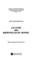
ISBN: 2271057442 9782271057440 Year: 2000 Volume: 31 Publisher: Paris : CNRS éditions,
Abstract | Keywords | Export | Availability | Bookmark
 Loading...
Choose an application
- Reference Manager
- EndNote
- RefWorks (Direct export to RefWorks)
Old French literature --- Geography, Medieval. --- Travel, Medieval. --- Géographie médiévale --- Voyage --- Histoire --- Mandeville, John, --- 091 JEAN DE MANDEVILLE --- Geography, Medieval --- Travel, Medieval --- Civilization, Medieval --- Geography --- Medieval geography --- Handschriftenkunde. Handschriftencatalogi--JEAN DE MANDEVILLE --- Mandeville, John Sir --- -Travel --- 091 JEAN DE MANDEVILLE Handschriftenkunde. Handschriftencatalogi--JEAN DE MANDEVILLE --- Géographie médiévale --- Mandeuile, Iohn, --- Mandevile, John, --- Mandevilla, Juan de, --- Mandevilla, Jean de, --- Mandeville, Johann von, --- Maundevile, John, --- Travel. --- Géographie historique --- Récits de voyages médiévaux --- Voyages --- Voyageurs --- Sources --- Mandeville, Jean de --- Critique et interprétation.
| Listing 1 - 10 of 28 | << page >> |
Sort by
|

 Search
 Feedback
 About
About Help
Help News
News