
 Search
 Feedback
 About UniCat
  Help
Help News
News
| Listing 1 - 3 of 3 |
Sort by
|
ISBN: 1282859196 9786612859199 0773569073 9780773569072 0773521666 9780773521667 2894481594 9782894481592 9781282859197 6612859199 Year: 2000 Publisher: [Sillery, Qué.] [Montréal, Qué.] Septentrion [McGill-Queen's University Press]
Abstract | Keywords | Export | Availability | Bookmark
 Loading...
Choose an application
- Reference Manager
- EndNote
- RefWorks (Direct export to RefWorks)
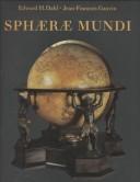
Advances in modern science and technology have made present-day terrestrial and celestial globes scientifically obsolete and aesthetically banal. From the Renaissance to the mid-nineteenth century, however, they were indispensable tools for the study of geography and astronomy. Beginning with an overview of early globes, the authors examine how the modern era in globe making, which began in Flemish and Dutch shops in the early seventeenth century, show how globe making spread throughout Europe, and explain how what were both decorative and scientific objects became symbols of power, universal knowledge, intellectual status, and personal vanity. Beginning with the collection's earliest globe, dated 1533, the authors introduce us to the life and works of some of the greatest Dutch, French, English, German, Italian, and Swedish globe makers. The 120 colour illustrations allow the reader to savour these rare and unusual works and include numerous detailed reproductions of both terrestrial and celestial map images. Sphæræ Mundi charts developments and changes over three centuries of globe making, considering the globes as indicators of scientific advance and geographical exploration as well as artifacts and providing a unique opportunity to become familiar with these complex and beautiful objects.
Globes
---
Celestial globes
---
Cartography
---
Maps
---
Globes, Celestial
---
Globes, Star
---
Star globes
---
Astronomical models
---
Celestial sphere
---
Cartographic materials
---
Orbs
---
World maps
---
History.
---
History
---
David M. Stewart Museum
---
Stewart Museum
---
Musée Stewart
---
Musée David M. Stewart
---
Montreal Military & Maritime Museum
---
094.2 <71 MONTREAL>
---
912.643
---
094.2 <71 MONTREAL> Oude drukken: bibliotheekcatalogi--
Book
ISBN: 0191642193 128371339X 9780191642197 9781283713399 9780199609697 0199609691 Year: 2012 Publisher: Oxford : Oxford University Press,
Abstract | Keywords | Export | Availability | Bookmark
Loading...Choose an application
- Reference Manager
- EndNote
- RefWorks (Direct export to RefWorks)
In this volume all extant celestial maps and globes made before 1500 are described and analysed. It also discusses the astronomical sources involved in making these artefacts in antiquity, the Middle Ages, the Islamic world and the European Renaissance before 1500.
Stars --- Sidereal system --- Galaxies --- Circumstellar matter --- Atlases --- History --- 091:912 --- 133.52 --- 524 --- 681.782.2 --- 912 <15> --- 912.643 --- 681.782.2 Astronomical observation and measuring instruments. Astrographs. Astrolabes. Transit instruments. Meridan circles. Zenith telescopes. Vertical circles --- Astronomical observation and measuring instruments. Astrographs. Astrolabes. Transit instruments. Meridan circles. Zenith telescopes. Vertical circles --- 524 Stars. Stellar systems. The Universe --- Stars. Stellar systems. The Universe --- 133.52 Astrologie. Horoscopen. Dierenriem --- Astrologie. Horoscopen. Dierenriem --- 091:912 Handschriftenkunde. Handschriftencatalogi-:-Cartografie. Kaarten. Plattegronden. Atlassen --- Handschriftenkunde. Handschriftencatalogi-:-Cartografie. Kaarten. Plattegronden. Atlassen --- Cartografie. Kaarten. Plattegronden. Atlassen--Kosmos --- Globes
ISBN: 2717721762 2717727663 2717726284 9782717721768 Year: 2002 Publisher: Éditions de la Bibliothèque nationale de France
Abstract | Keywords | Export | Availability | Bookmark
Loading...Choose an application
- Reference Manager
- EndNote
- RefWorks (Direct export to RefWorks)
Les quatre textes publiés dans ce volume concernent deux périodes importantes pour la cartographie française, la Renaissance et le Siècle des lumières, qui ont posé des règles pour la mesure et la description du territoire. Ces deux activités ont été pratiquées par des hommes de formations diverses – mathématiciens, ingénieurs, peintres, géographes – dont les talents étaient parfois concurrents et souvent complémentaires. Les uns ont proposé des méthodes dans le cadre de prestigieuses institutions comme le Collège royal (actuel Collège de France), l'Académie des sciences ou l'Académie de marine. D'autres étaient plus directement confrontés au terrain qu'ils devaient décrire pour différentes catégories d'usagers : juges, administrateurs, militaires, navigateurs, historiens, etc. Toutefois les uns et les autres ont œuvré, directement ou indirectement, pour le pouvoir royal, maître non seulement de la cartographie de la France, mais encore de la description du monde. Certes, le contrôle exercé par ce pouvoir et l'intérêt manifesté par les rois et leurs ministres ont pu favoriser les progrès de la cartographie et encourager la publication de documents illustrant les actions glorieuses du monarque et la grandeur de la France, mais ils ont aussi restreint la diffusion de certaines cartes dont l'importance stratégique était évidente. Même s'ils ne sont pas toujours apparents, les objectifs poursuivis par les cartographes et le mode d'utilisation de leurs productions sont toujours pris en considération dans ces quatre études, et ce indépendamment de la date de production des documents.
Cartography
---
Globes
---
Military engineering
---
Geografie
---
History
---
Cartografie
---
Historische Cartografie.
---
Cartography - France - History.
---
Globes - France - History.
---
Military engineering - France - History.
---
Geography
---
Earth & Environmental Sciences
---
#BIBC:ruil
| Listing 1 - 3 of 3 |
Sort by
|