
 Search
 Feedback
 About
About Help
Help News
News
| Listing 1 - 10 of 11 | << page >> |
Sort by
|
Book
ISBN: 9780952773313 0952773309 Year: 1996 Publisher: Rickmansworth Raleigh Publications
Abstract | Keywords | Export | Availability | Bookmark
 Loading...
Choose an application
- Reference Manager
- EndNote
- RefWorks (Direct export to RefWorks)
Book
ISBN: 9064697043 9789064697043 Year: 1996 Volume: 5 Publisher: Alphen aan den Rijn : Canaletto,
Abstract | Keywords | Export | Availability | Bookmark
Loading...Choose an application
- Reference Manager
- EndNote
- RefWorks (Direct export to RefWorks)
Cartography --- Maps --- History. --- 912 <09> <492> --- 912 <09> <493-17> --- 912 "16" --- Cartografie. Kaarten. Plattegronden. Atlassen--Geschiedenis van ...--Nederland --- Cartografie. Kaarten. Plattegronden. Atlassen--Geschiedenis van ...--Vlaanderen. Vlaams Gewest. Nederlandstalige Gemeenschap in België --- Cartografie. Kaarten. Plattegronden. Atlassen--17e eeuw. Periode 1600-1699 --- Cartography - Netherlands - History. --- Maps - Facsimiles. --- PAYS-BAS --- CARTES
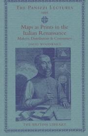
ISBN: 0712345027 Year: 1996 Volume: 1995 Publisher: London The British Library
Abstract | Keywords | Export | Availability | Bookmark
Loading...Choose an application
- Reference Manager
- EndNote
- RefWorks (Direct export to RefWorks)
anno 1500-1599
---
Italy
---
Engraving, Italian
---
Map printing
---
Geografie
---
History.
---
Cartografie
---
Historische Cartografie.
---
912 <09> <45>
---
912 "15"
---
655.3.026
---
094.1 <45>
---
76 <45> "15"
---
76.047 <45>
---
-Engraving, Italian
---
-Italian engraving
---
Maps
---
Maps, Printing of
---
Cartography
---
Printing
---
Cartografie. Kaarten. Plattegronden. Atlassen--Geschiedenis van ...--Italië
---
Cartografie. Kaarten. Plattegronden. Atlassen--16e eeuw. Periode 1500-1599
---
Drukken van specifiek drukwerk. Drukken van kranten, postzegels, kaarten, commercieel drukwerk
---
Oude drukken: bibliografie--
Book

ISBN: 8876632107 9788876632105 Year: 1996 Volume: 4 Publisher: Urbania Edizioni Biblioteca e Civico Museo di Urbania
Abstract | Keywords | Export | Availability | Bookmark
Loading...Choose an application
- Reference Manager
- EndNote
- RefWorks (Direct export to RefWorks)
Mercator, Gerard
---
Cartography
---
History
---
Exhibitions.
---
912 <09> <493>
---
094 MERCATOR, GERARDUS
---
094.2 <45 URBANIA>
---
-Cartography, Primitive
---
Chartography
---
Map-making
---
Mapmaking
---
Mapping (Cartography)
---
Mathematical geography
---
Surveying
---
Map projection
---
Maps
---
Cartografie. Kaarten. Plattegronden. Atlassen--Geschiedenis van ...--België
---
Oude en merkwaardige drukken. Kostbare en zeldzame boeken. Preciosa en rariora--MERCATOR, GERARDUS
---
Oude drukken: bibliotheekcatalogi--

ISBN: 019727501X Year: 1996 Publisher: Oxford Oxford university press
Abstract | Keywords | Export | Availability | Bookmark
Loading...Choose an application
- Reference Manager
- EndNote
- RefWorks (Direct export to RefWorks)
Atlases, Turkish --- Cartographers --- Cartography --- Cartography. --- Turkey. --- Early works to 1800. --- History --- Pirî Reis, --- Nasser D. Khalili Collection of Islamic Art. Manuscript. MSS718. --- Geodesy. Cartography --- Piri Reïs, Moehji al-din --- 912 <09> <560> --- 912 "15" --- 912 <4-015> --- 912 <26> --- 912:551.46 --- -Cartographers --- -Cartography --- -Cartography, Primitive --- Chartography --- Map-making --- Mapmaking --- Mapping (Cartography) --- Mathematical geography --- Surveying --- Map projection --- Mapmakers --- Earth scientists --- Turkish atlases --- Cartografie. Kaarten. Plattegronden. Atlassen--Geschiedenis van ...--Turkije --- Cartografie. Kaarten. Plattegronden. Atlassen--16e eeuw. Periode 1500-1599 --- Cartografie. Kaarten. Plattegronden. Atlassen--Middellandse-Zeegebied --- Cartografie. Kaarten. Plattegronden. Atlassen--Oceanen. Zeeën. Zeestraten en zeeverbindingen --- Kaarten. Atlassen: oceanen --- Piri Reis --- -Cartografie. Kaarten. Plattegronden. Atlassen--Geschiedenis van ...--Turkije --- 912:551.46 Kaarten. Atlassen: oceanen --- -912:551.46 Kaarten. Atlassen: oceanen --- Cartography, Primitive --- Maps --- Pirı̂ Reis, --- Ahmet Muhiddin Piri, --- Pı̄rı̄ Muḥyi ʼl-Dīn Reʼis, --- Pirî, --- Pirî Reis,
Abstract | Keywords | Export | Availability | Bookmark
Loading...Choose an application
- Reference Manager
- EndNote
- RefWorks (Direct export to RefWorks)
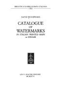
Cartography --- Watermarks --- History --- 09:676 <45> --- 745.543 --- 912 <09> <45> --- -Watermarks --- -Filigrains --- Marks in paper --- Water-marks --- Marks of origin --- Cartography, Primitive --- Chartography --- Map-making --- Mapmaking --- Mapping (Cartography) --- Mathematical geography --- Surveying --- Map projection --- Maps --- Handschriften en oude drukken: papier, watermerken--Italië --- Watermerken --- Cartografie. Kaarten. Plattegronden. Atlassen--Geschiedenis van ...--Italië --- -History --- -09:676 <45> --- -Handschriften en oude drukken: papier, watermerken--Italië --- -09:676 <45> Handschriften en oude drukken: papier, watermerken--Italië --- Filigrains --- 745.543 Watermerken --- -745.543 Watermerken --- 09:676 <45> Handschriften en oude drukken: papier, watermerken--Italië --- -Cartography --- Cartography - Italy - History - 16th century. --- Watermarks - Italy - History - 16th century.
Book
ISBN: 3799531645 Year: 1996 Publisher: Sigmaringen Thorbecke
Abstract | Keywords | Export | Availability | Bookmark
Loading...Choose an application
- Reference Manager
- EndNote
- RefWorks (Direct export to RefWorks)
094:72
---
725.18
---
094.1 <44 STRASBOURG>
---
912 <09> <43>
---
Oude en merkwaardige drukken. Kostbare en zeldzame boeken. Preciosa en rariora-:-Architectuur. Bouwkunst
---
Militaire bouwkunst
---
Oude drukken: bibliografie--
ISBN: 9061943086 Year: 1996 Publisher: 't Goy, The Netherlands HES Publishers BV
Abstract | Keywords | Export | Availability | Bookmark
Loading...Choose an application
- Reference Manager
- EndNote
- RefWorks (Direct export to RefWorks)
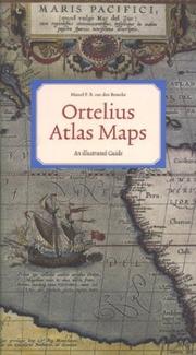
This book is a guide that provides information on the occurrence of each map in various atlas editions, thus allowing the reader to determine from which edition a loose map derives. It also provides information on the various states that most maps went through, and gives their cartographical sources. Many new maps have been identified by the author, and are described here for the first time.
Geodesy. Cartography --- Ortelius, Abraham --- Intercontinental regions --- Ortelius Abraham. Theatrum Orbis Terrarum --- 912 <09> <493> --- 912 "15" --- 912 <100> --- 094 ORTELIUS, ABRAHAM --- Cartografie. Kaarten. Plattegronden. Atlassen--Geschiedenis van ...--België --- Cartografie. Kaarten. Plattegronden. Atlassen--16e eeuw. Periode 1500-1599 --- Cartografie. Kaarten. Plattegronden. Atlassen--Wereld. Internationaal. Alle landen gezamenlijk --- Oude en merkwaardige drukken. Kostbare en zeldzame boeken. Preciosa en rariora--ORTELIUS, ABRAHAM --- Geografie --- Atlases --- Atlases, Dutch --- Cartography --- Cartografie --- Historische Cartografie. --- Ortelius, Abraham, --- Catalogs. --- 094 ORTELIUS, ABRAHAM Oude en merkwaardige drukken. Kostbare en zeldzame boeken. Preciosa en rariora--ORTELIUS, ABRAHAM --- atlases --- cartography [discipline] --- Cartography, Primitive --- Chartography --- Map-making --- Mapmaking --- Mapping (Cartography) --- Mathematical geography --- Surveying --- Map projection --- Maps --- Dutch atlases --- Early works to 1800 --- Belgium --- History --- Llwyd, Humphrey, --- Ortel, Abraham, --- Oertel, Abraham, --- Ortels, Abraham, --- Ortelio, Abramo, --- Ortelius, Abrahamus, --- Hortel, Abraham, --- Ortell, Abraham, --- Wortels, Abraham, --- Bartolus, --- Ortelio, Abraamo, --- Bartolus, Abraham, --- Bartholus Arameis, Abraham, --- Ortelius, A. --- Orthellius, Abraham, --- Ortellio, Abram, --- Mercator, Gerhard, --- Hoefnagel, Joris, --- Plantin, Christophe, --- Camden, William, --- Meteren, Emmanuel van, --- Philip
Book
ISBN: 2910460037 Year: 1996 Publisher: Paris Relations internationales & culture
Abstract | Keywords | Export | Availability | Bookmark
Loading...Choose an application
- Reference Manager
- EndNote
- RefWorks (Direct export to RefWorks)
912 <09> <680>
---
910.4 <680>
---
Discoveries in geography
---
-Travelers
---
-#BIBC:ruil
Book
ISBN: 3874373886 Year: 1996
Abstract | Keywords | Export | Availability | Bookmark
Loading...Choose an application
- Reference Manager
- EndNote
- RefWorks (Direct export to RefWorks)
Cartography
---
094.2 <43 BERLIN>
---
912 <09> <43>
---
Cartography, Primitive
---
Chartography
---
Map-making
---
Mapmaking
---
Mapping (Cartography)
---
Mathematical geography
---
Surveying
---
Map projection
---
Maps
---
094.2 <43 BERLIN> Oude drukken: bibliotheekcatalogi--
| Listing 1 - 10 of 11 | << page >> |
Sort by
|