
 Search
 Feedback
 About UniCat
  Help
Help News
News
| Listing 1 - 10 of 10 |
Sort by
|
Book
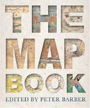
ISBN: 1405478985 9781405478984 Year: 2005 Publisher: Bath Parragon books
Abstract | Keywords | Export | Availability | Bookmark
 Loading...
Choose an application
- Reference Manager
- EndNote
- RefWorks (Direct export to RefWorks)
912 <09> --- 912:930 --- Cartografie. Kaarten. Plattegronden. Atlassen--Geschiedenis van ... --- Cartografie. Kaarten. Plattegronden. Atlassen-:-Geschiedwetenschap. Hulpwetenschappen der geschiedenis --- Cartografie. Kaarten. Plattegronden. Atlassen--Geschiedenis van .. --- Cartografie. Kaarten. Plattegronden. Atlassen--Geschiedenis van . --- Cartografie. Kaarten. Plattegronden. Atlassen--Geschiedenis van
ISBN: 0297843729 9780297843726 Year: 2005 Publisher: London Weidenfeld and Nicolson
Abstract | Keywords | Export | Availability | Bookmark
Loading...Choose an application
- Reference Manager
- EndNote
- RefWorks (Direct export to RefWorks)
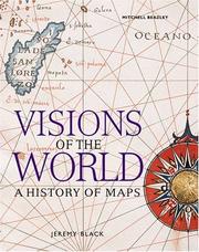
Maps are not just diagrams of the route from A to B - from the earliest times they have helped us make sense of our world, from the very local to the global. Simply organised as a progression through time, each map is not only a beautiful work of art in its own right but also tells us about our changing perception of the earth. Sometimes, of course, maps tell lies and there are examples represented here that are meant to alter or influence our understanding of the world around us. There are maps of oceans and continents charted by heroic adventurers sailing into the unknown, at sea for years in tiny ships. For every example of a beautifully embellished map that has survived there must have been scores of cartographers who perished at sea or in 'unknown parts'. Maps are not just about understanding and representing the physical world: they have an administrative use in demarcating national boundaries or individual plots of land, a social use in showing who lives where, a military use in depicting the layout of enemy positions, a political or propaganda use in showing one country or faction at an advantage over others. All are represented in this book, a history of the world in images from around the globe and from every epoch.
912 <09> --- Cartografie. Kaarten. Plattegronden. Atlassen--Geschiedenis van ... --- Geodesy. Cartography --- cartography [discipline] --- Cartografie. Kaarten. Plattegronden. Atlassen--Geschiedenis van .. --- Cartografie. Kaarten. Plattegronden. Atlassen--Geschiedenis van . --- Cartografie. Kaarten. Plattegronden. Atlassen--Geschiedenis van
ISBN: 1840008342 9781840008340 Year: 2005 Publisher: London Octopus
Abstract | Keywords | Export | Availability | Bookmark
Loading...Choose an application
- Reference Manager
- EndNote
- RefWorks (Direct export to RefWorks)
Taking in cartography from all over the globe, "Visions of the World" charts the exploration and mapping of the planet - from before the age of printing to modern satellite imaging - telling the stories of the cartographers, explorers, inventors and surveyors who have mapped it. Illustrated with colour reproductions of the most important maps and charts from around the world, this book explores the way that maps have been used: to distort knowledge; to fool enemies; to build and administer empires; to show the world from different cultural and economic perspectives; and to map the rapidly changing physical face of the planet in the modern world.
Cartography --- History. --- 912 <036> --- Cartografie. Kaarten. Plattegronden. Atlassen--Gidsen. Inleidingen --- 912 <09> --- Maps --- History --- Cartografie. Kaarten. Plattegronden. Atlassen--Geschiedenis van .. --- Graphics industry --- Geodesy. Cartography --- Cartografie. Kaarten. Plattegronden. Atlassen--Geschiedenis van . --- Cartografie. Kaarten. Plattegronden. Atlassen--Geschiedenis van
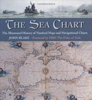
ISBN: 085177945X 9780851779454 Year: 2005 Publisher: London Conway Maritime Press
Abstract | Keywords | Export | Availability | Bookmark
Loading...Choose an application
- Reference Manager
- EndNote
- RefWorks (Direct export to RefWorks)
912 <26> --- 912:551.46 --- 912 <09> --- Cartografie. Kaarten. Plattegronden. Atlassen--Oceanen. Zeeën. Zeestraten en zeeverbindingen --- Kaarten. Atlassen: oceanen --- Cartografie. Kaarten. Plattegronden. Atlassen--Geschiedenis van ... --- 912:551.46 Kaarten. Atlassen: oceanen --- Discoveries in geography --- Nautical charts --- History --- Cartografie. Kaarten. Plattegronden. Atlassen--Geschiedenis van .. --- Cartografie. Kaarten. Plattegronden. Atlassen--Geschiedenis van . --- Cartografie. Kaarten. Plattegronden. Atlassen--Geschiedenis van
Book
ISBN: 2951095961 9782951095960 Year: 2005 Publisher: Castelnau-le-Lez Prado
Abstract | Keywords | Export | Availability | Bookmark
Loading...Choose an application
- Reference Manager
- EndNote
- RefWorks (Direct export to RefWorks)
929 MERCATOR, GERARDUS --- 912 "15" --- 912 <09> <493> --- Biografie. Genealogie. Heraldiek--MERCATOR, GERARDUS --- Cartografie. Kaarten. Plattegronden. Atlassen--16e eeuw. Periode 1500-1599 --- Cartografie. Kaarten. Plattegronden. Atlassen--Geschiedenis van ...--België --- 929 MERCATOR, GERARDUS Biografie. Genealogie. Heraldiek--MERCATOR, GERARDUS
Book

ISBN: 9064698074 Year: 2005 Publisher: Alphen aan den Rijn Canaletto/Repro Holland
Abstract | Keywords | Export | Availability | Bookmark
Loading...Choose an application
- Reference Manager
- EndNote
- RefWorks (Direct export to RefWorks)
Book history --- Geodesy. Cartography --- Keulen, van [Family] --- 912 <09> <492> --- 912 <26> --- 912 "16" --- 912 "17" --- 912 "18" --- Cartografie. Kaarten. Plattegronden. Atlassen--Geschiedenis van ...--Nederland --- Cartografie. Kaarten. Plattegronden. Atlassen--Oceanen. Zeeën. Zeestraten en zeeverbindingen --- Cartografie. Kaarten. Plattegronden. Atlassen--17e eeuw. Periode 1600-1699 --- Cartografie. Kaarten. Plattegronden. Atlassen--18e eeuw. Periode 1700-1799 --- Cartografie. Kaarten. Plattegronden. Atlassen--19e eeuw. Periode 1800-1899 --- Cartography --- Manuscript maps --- Maps --- Nautical charts --- Charts, Nautical --- Hydrographic charts --- Inland navigation --- Navigation --- Navigation charts --- Navigation maps --- Pilot charts --- Aids to navigation --- Nautical paraphernalia --- Notices to mariners --- Plans --- Cartographic materials --- Geography --- Maps, Manuscript --- Manuscripts --- Cartography, Primitive --- Chartography --- Map-making --- Mapmaking --- Mapping (Cartography) --- Mathematical geography --- Surveying --- Map projection --- History --- Van Keulen (Firm) --- History.
ISBN: 0226653412 9780226653419 9780226817583 Year: 2005 Volume: *5 Publisher: Chicago University of Chicago Press
Abstract | Keywords | Export | Availability | Bookmark
Loading...Choose an application
- Reference Manager
- EndNote
- RefWorks (Direct export to RefWorks)
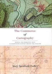
Though the political and intellectual history of mapmaking in the eighteenth century is well established, the details of its commercial revolution have until now been widely scattered. In The Commerce of Cartography, Mary Pedley presents a vivid picture of the costs and profits of the mapmaking industry in England and France, and reveals how the economics of map trade affected the content and appearance of the maps themselves. Conceptualizing the relationship between economics and cartography, Pedley traces the process of mapmaking from compilation, production, and marketing to consumption, reception, and criticism. In detailing the rise of commercial cartography, Pedley explores qualitative issues of mapmaking as well. Why, for instance, did eighteenth-century ideals of aesthetics override the modern values of accuracy and detail? And what, to an eighteenth-century mind and eye, qualified as a good map? A thorough and engaging study of the business of cartography during the Enlightenment, The Commerce of Cartography charts a new cartographic landscape and will prove invaluable to scholars of economic history, historical geography, and the history of publishing.
912 "17" --- 912 <09> <41> --- 912 <09> <44> --- Cartografie. Kaarten. Plattegronden. Atlassen--18e eeuw. Periode 1700-1799 --- Cartografie. Kaarten. Plattegronden. Atlassen--Geschiedenis van ...--Verenigd Koninkrijk van Groot-Brittannië en Noord-Ierland --- Cartografie. Kaarten. Plattegronden. Atlassen--Geschiedenis van ...--Frankrijk --- Cartography --- Map industry and trade --- Map trade --- Manufacturing industries --- Cartography, Primitive --- Chartography --- Map-making --- Mapmaking --- Mapping (Cartography) --- Mathematical geography --- Surveying --- Map projection --- Maps --- History --- 912 <41> --- 912 <44> --- 912:33 --- Cartografie. Kaarten. Plattegronden. Atlassen-:-Handel. --- 912 "17" Cartografie. Kaarten. Plattegronden. Atlassen--18e eeuw. Periode 1700-1799 --- 912 "17" Cartography. Maps. Atlasses--18e eeuw. Periode 1700-1799 --- Cartography. Maps. Atlasses--18e eeuw. Periode 1700-1799 --- 912 <44> Cartografie. Kaarten. Plattegronden. Atlassen--Frankrijk --- 912 <44> Cartography. Maps. Atlasses--Frankrijk --- Cartografie. Kaarten. Plattegronden. Atlassen--Frankrijk --- Cartography. Maps. Atlasses--Frankrijk --- 912 <41> Cartografie. Kaarten. Plattegronden. Atlassen--Verenigd Koninkrijk van Groot-Brittannië en Noord-Ierland --- 912 <41> Cartography. Maps. Atlasses--Verenigd Koninkrijk van Groot-Brittannië en Noord-Ierland --- Cartografie. Kaarten. Plattegronden. Atlassen--Verenigd Koninkrijk van Groot-Brittannië en Noord-Ierland --- Cartography. Maps. Atlasses--Verenigd Koninkrijk van Groot-Brittannië en Noord-Ierland --- Cartografie. Kaarten. Plattegronden. Atlassen-:-Handel
Book
ISBN: 2714308945 9782714308948 Year: 2005 Volume: 26 Publisher: Paris José Corti
Abstract | Keywords | Export | Availability | Bookmark
Loading...Choose an application
- Reference Manager
- EndNote
- RefWorks (Direct export to RefWorks)
Geodesy. Cartography
---
anno 1500-1599
---
Europe: North
---
Baltic Sea
---
094 OLAUS, MAGNUS
---
912 <09> <48>
---
912 <26>
---
912:551.46
---
912 "15"
---
094.2 <485 UPPSALA>
---
Oude en merkwaardige drukken. Kostbare en zeldzame boeken. Preciosa en rariora--OLAUS, MAGNUS
---
Cartografie. Kaarten. Plattegronden. Atlassen--Geschiedenis van ...--Skandinavië
---
Cartografie. Kaarten. Plattegronden. Atlassen--Oceanen. Zeeën. Zeestraten en zeeverbindingen
---
Kaarten. Atlassen: oceanen
---
Cartografie. Kaarten. Plattegronden. Atlassen--16e eeuw. Periode 1500-1599
---
Oude drukken: bibliotheekcatalogi--
Book
ISBN: 905730368X 9789057303685 Year: 2005 Publisher: Zutphen Walburg pers
Abstract | Keywords | Export | Availability | Bookmark
Loading...Choose an application
- Reference Manager
- EndNote
- RefWorks (Direct export to RefWorks)
History of the Low Countries
---
Verenigde Oost-Indische Compagnie
---
anno 1700-1799
---
912 <09> <492>
---
912 <09> <493>
---
912 <261.6>
---
912 <267>
---
910.4 <492> "16"
---
910.4 <492> "17"
---
Cartografie. Kaarten. Plattegronden. Atlassen--Geschiedenis van ...--Nederland
---
Cartografie. Kaarten. Plattegronden. Atlassen--Geschiedenis van ...--België
---
Cartografie. Kaarten. Plattegronden. Atlassen--Westelijke en Zuidwestelijke Atlantische Oceaan
---
Cartografie. Kaarten. Plattegronden. Atlassen--Indische Oceaan
---
Ontdekkingsreizen. Reizen. Expedities. Reisverhalen--
Book
ISBN: 9064697876 9789064697876 Year: 2005 Publisher: Alphen aan den Rijn: Canaletto,
Abstract | Keywords | Export | Availability | Bookmark
Loading...Choose an application
- Reference Manager
- EndNote
- RefWorks (Direct export to RefWorks)
History of the Low Countries --- Geodesy. Cartography --- anno 1600-1699 --- anno 1700-1799 --- Cartography --- Cartographie --- History --- Histoire --- Netherlands --- Pays-Bas --- Historical geography --- Maps --- Géographie historique --- Cartes --- Early maps --- 912 <09> <492> --- 912 "16" --- 912 "17" --- 949.2.04 --- Cartografie. Kaarten. Plattegronden. Atlassen--Geschiedenis van ...--Nederland --- Cartografie. Kaarten. Plattegronden. Atlassen--17e eeuw. Periode 1600-1699 --- Cartografie. Kaarten. Plattegronden. Atlassen--18e eeuw. Periode 1700-1799 --- Geschiedenis van Nederland:--(1648-1795) --- 949.2.04 Geschiedenis van Nederland:--(1648-1795) --- Géographie historique --- Cartography, Primitive --- Chartography --- Map-making --- Mapmaking --- Mapping (Cartography) --- Mathematical geography --- Surveying --- Map projection --- Maps, Early --- Geography --- The Netherlands --- Países Baixos --- Holland --- Spanish Netherlands --- Pays-Bas espagnols --- Austrian Netherlands --- Pays-Bas autrichiens --- Oostenrijkse Nederlanden --- Southern Netherlands --- Pays-Bas méridionaux --- Zuidelijke Nederlanden --- Niderlandy --- Belanda --- Nederland --- Koninkrijk der Nederlanden --- Reino dos Países Baixos --- Royaume des Pays-Bas --- Kingdom of the Netherlands --- Países Bajos --- Holanda --- Nederlân --- Hulanda --- Beulanda --- Niderland --- Niderlande --- هولندا --- مملكة هولندا --- Mamlakat Hūlandā --- Olanda --- Payis-Bâs --- Países Baxos --- Aynacha Jach'a Markanaka --- Nirlan --- Niderland Krallığı --- Kē-tē-kok --- Landa --- Kerajaan Landa --- Нидерландтар --- Niderlandtar --- Нидерландтар Короллеге --- Niderlandtar Korollege --- Нідэрланды --- Каралеўства Нідэрланды --- Karaleŭstva Nidėrlandy --- Nederlands --- Niadaland --- Holandija --- Kraljevina Holandija --- Izelvroioù --- Нидерландия --- Niderlandii︠a︡ --- Кралство Нидерландия --- Kralstvo Niderlandii︠a︡ --- Països Baixos --- Нидерландсем --- Niderlandsem --- Нидерландсен Патшалăхĕ --- Niderlandsen Patshalăkhĕ --- Nizozemsko --- Paesi Bassi --- Regnu di i Paesi Bassi --- Iseldiroedd --- Nederlandene --- Niederlande --- Kéyah Wóyahgo Siʼánígíí --- Nižozemska --- Kralojstwo Nederlandow --- Madalmaad --- Ολλανδία --- Ollandia --- Hollandia --- Κάτω Χώρες --- Katō Chōres --- Βασίλειο των Κάτω Χωρών --- Vasileio tōn Katō Chōrōn --- Nederlando --- Reĝlando Nederlando --- Paisis Bajus --- Herbehereak --- Herbehereetako Erresumaren --- هلند --- Huland --- Niðurlond --- Háland --- Paîs Bas --- Neerlande --- Ísiltír --- Ríocht na hÍsiltíre --- Çheer Injil --- Çheer y Vagheragh --- Reeriaght ny Çheer Injil --- Tìrean Ìsle --- Hò-làn --- Недерлендин Нутг --- Nederlendin Nutg --- 네덜란드 --- Nedŏllandŭ --- Hōlani --- Nederlandia --- Pais Basse --- Regno del Paises Basse --- Нидерландтæ --- Niderlandtæ --- Нидерландты Къаролад --- Niderlandty Kʺarolad --- Konungsríkið Holland --- הולנד --- Holand --- ממלכת ארצות השפלה --- Mamlekhet Artsot ha-Shefelah --- Walanda --- Hollandi --- Нидерландла --- Niderlandla --- Нидерландланы Королевствосу --- Niderlandlany Korolevstvosu --- Néderlandzkô --- Нидерланд --- Iseldiryow --- Ubuholandi --- Ubuhorandi --- Nederilande --- Нидерланддар --- Niderlanddar --- Uholanzi --- Ufalme wa Nchi za Chini --- Нидерландъяс --- Niderlandʺi︠a︡s --- Нидерландъяс Корольув --- Niderlandʺi︠a︡s Korolʹuv --- Peyiba --- Holenda --- Keyatiya Nederlandan --- Payises Bashos --- פאייסיס באשוס --- Nīderlandeja --- Batavia --- Regni Nederlandiarum --- Nīderlandes Karaliste --- Nyderlandai --- Nyderlandų Karalystė --- Paixi Basci --- Paes Bass --- Ulanda --- Holland Királyság --- Keninkryk fan 'e Nederlannen --- Reino di Hulanda --- Холандија --- Кралство Холандија --- Kralstvo Holandija --- Pajjiżi l-Baxxi --- Hōrana --- Недерлатт --- Nederlatt --- Оцязорксши Недерлатт --- Ot︠s︡i︠a︡zorksshi Nederlatt --- Нидерландын Вант Улс --- Niderlandyn Vant Uls --- Tlanitlālpan --- Huēyitlahtohcāyōtl in Tlanitlālpan --- Eben Eyong --- Nederlaand --- オランダ --- Oranda --- オランダ王国 --- Oranda Ōkoku --- Ulanna --- Nethiland --- Nederlande --- Holandska --- Holland (Kingdom) --- Batavian Republic --- United Provinces of the Netherlands --- Early maps - Netherlands - Catalogs. --- Cartography - Netherlands - History - 17th century. --- Cartography - Netherlands - History - 18th century.
| Listing 1 - 10 of 10 |
Sort by
|