| Listing 1 - 8 of 8 |
Sort by
|

ISBN: 0849398983 Year: 2006 Publisher: Boca Raton (Fla.) : Taylor & Francis,
Abstract | Keywords | Export | Availability | Bookmark
 Loading...
Choose an application
- Reference Manager
- EndNote
- RefWorks (Direct export to RefWorks)
Organized into four major parts, this book begins by presenting a historical overview of the issues involved in integrating GIS and AEC (architecture, engineering, construction) systems. Part II then focuses on the data issue from several viewpoints: data collection; database structures and representation; database management; and visualization. Part III covers the areas of semantics, ontology, and standardization from a theoretical perspective and details many of the best examples of this approach in developing real-world applications. The book concludes with contributions that focus on recent advances in virtual geographic environments and alternative modeling schemes for the potential AEC/GIS interface.

ISBN: 1420070681 9781420070682 Year: 2008 Publisher: Boca Raton (Fla.) : CRC press,
Abstract | Keywords | Export | Availability | Bookmark
 Loading...
Choose an application
- Reference Manager
- EndNote
- RefWorks (Direct export to RefWorks)
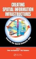
Geografie --- Semantic Web. --- Spatial data infrastructures. --- Geografische Informatie Systemen --- Data.
Digital
ISBN: 9783540274681 Year: 2005 Publisher: Berlin, Heidelberg Springer-Verlag Berlin Heidelberg
Abstract | Keywords | Export | Availability | Bookmark
 Loading...
Choose an application
- Reference Manager
- EndNote
- RefWorks (Direct export to RefWorks)
Mathematics --- Geodesy. Cartography --- Geology. Earth sciences --- Environmental protection. Environmental technology --- Information systems --- Computer. Automation --- geodesie --- ICT (informatie- en communicatietechnieken) --- informatica --- informatiesystemen --- milieuzorg --- wiskunde --- geografie --- geologie --- milieutechnologie --- milieubeheer --- milieuanalyse
Book
ISBN: 3642034411 9786612833700 364203442X 1282833707 Year: 2010 Publisher: Berlin : Springer,
Abstract | Keywords | Export | Availability | Bookmark
 Loading...
Choose an application
- Reference Manager
- EndNote
- RefWorks (Direct export to RefWorks)
Cartography and geographic information (GI) are remarkably appropriate for the requirements of early warning (EW) and crisis management (CM). The use of geospatial technology has increased tremendously in the last years. ICT has changed from just using maps created in advance, to new approaches, allowing individuals (decision-makers) to use cartography interactively, on the basis of individual user's requirements. The new generation of cartographic visualizations based on standardisation, formal modelling, use of sensors, semantics and ontology, allows for the better adaptation of information to the needs of the users. In order to design a new framework in pre-disaster and disaster management safety/security/privacy aspects of institutions and citizens need to be considered. All this can only be achieved by demonstrating new research achievements, sharing best practices (e.g. in the health area) and working towards the wider acceptance of geospatial technology in society, with the help of education and media. This book will outline research frontiers and applications of cartography and GI in EW and CM and document their roles and potentials in wider processes going on in information/knowledge-based societies.
Climate change mitigation. --- Crisis management -- Case studies. --- Emergency management -- Case studies. --- Risk management -- Case studies. --- Emergency management --- Disaster relief --- Geographic information systems --- Cartography --- Social Welfare & Social Work - General --- Geography --- Social Welfare & Social Work --- Social Sciences --- Earth & Environmental Sciences --- Data processing --- Computer programs --- Emergency management. --- Geographic information systems. --- Computer network resources. --- Consequence management (Emergency management) --- Disaster planning --- Disaster preparedness --- Disaster prevention --- Disasters --- Emergencies --- Emergency planning --- Emergency preparedness --- Management --- Planning --- Preparedness --- Prevention --- Geography. --- Business. --- Management science. --- Earth sciences. --- Geophysics. --- Geographical information systems. --- Geographical Information Systems/Cartography. --- Geophysics/Geodesy. --- Business and Management, general. --- Earth Sciences, general. --- Geographical information systems --- GIS (Information systems) --- Information storage and retrieval systems --- Geological physics --- Terrestrial physics --- Earth sciences --- Physics --- Geosciences --- Environmental sciences --- Physical sciences --- Quantitative business analysis --- Problem solving --- Operations research --- Statistical decision --- Trade --- Economics --- Commerce --- Industrial management --- Cosmography --- World history --- Public safety --- First responders
Book
ISBN: 3540873945 3642099513 9786611875718 1281875716 3540873953 Year: 2009 Publisher: Berlin, Heidelberg : Springer Berlin Heidelberg : Imprint: Springer,
Abstract | Keywords | Export | Availability | Bookmark
 Loading...
Choose an application
- Reference Manager
- EndNote
- RefWorks (Direct export to RefWorks)
In recent years 3D geo-information has become an important research area due to the increased complexity of tasks in many geo-scientific applications, such as sustainable urban planning and development, civil engineering, risk and disaster management and environmental monitoring. Moreover, a paradigm of cross-application merging and integrating of 3D data is observed. The problems and challenges facing today’s 3D software, generally application-oriented, focus almost exclusively on 3D data transportability issues – the ability to use data originally developed in one modelling/visualisation system in other and vice versa. Tools for elaborated 3D analysis, simulation and prediction are either missing or, when available, dedicated to specific tasks. In order to respond to this increased demand, a new type of system has to be developed. A fully developed 3D geo-information system should be able to manage 3D geometry and topology, to integrate 3D geometry and thematic information, to analyze both spatial and topological relationships, and to present the data in a suitable form. In addition to the simple geometry types like point line and polygon, a large variety of parametric representations, freeform curves and surfaces or sweep shapes have to be supported. Approaches for seamless conversion between 3D raster and 3D vector representations should be available, they should allow analysis of a representation most suitable for a specific application.
Geographic information systems --Congresses. --- Three-dimensional display systems --Congresses. --- Geographic information systems --- Three-dimensional display systems --- Geography --- Earth & Environmental Sciences --- Geography-General --- Cartography --- Geography. --- Computer graphics. --- Geographical information systems. --- Geographical Information Systems/Cartography. --- Computer Imaging, Vision, Pattern Recognition and Graphics. --- Computer vision. --- Machine vision --- Vision, Computer --- Artificial intelligence --- Image processing --- Pattern recognition systems --- Geographical information systems --- GIS (Information systems) --- Information storage and retrieval systems --- Optical data processing. --- Optical computing --- Visual data processing --- Bionics --- Electronic data processing --- Integrated optics --- Photonics --- Computers --- Optical equipment
Book
ISBN: 9783540274681 Year: 2005 Publisher: Berlin Heidelberg Springer Berlin Heidelberg
Abstract | Keywords | Export | Availability | Bookmark
 Loading...
Choose an application
- Reference Manager
- EndNote
- RefWorks (Direct export to RefWorks)
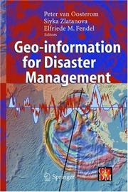
Geo-information technology offers an opportunity to support disaster management: industrial accidents, road collisions, complex emergencies, earthquakes, fires, floods and similar catastrophes (for example the recent huge disaster with the Tsunami in South-East Asia on 26 December 2004). Access to needed information, facilitation of the interoperability of emergency services, and provision of high-quality care to the public are a number of the key requirements. Such requirements pose significant challenges for data management, discovery, translation, integration, visualization and communication based on the semantics of the heterogeneous (geo-) information sources with differences in many aspects: scale/resolution, dimension (2D or 3D), classification and attribute schemes, temporal aspects (up-to-date-ness, history, predictions of the future), spatial reference system used, etc. The book provides a broad overview of the (geo-information) technology, software, systems needed, used and to be developed for disaster management. The book provokes a wide discussion on systems and requirements for use of geo-information under time and stress constraints and unfamiliar situations, environments and circumstances.
Mathematics --- Geodesy. Cartography --- Geology. Earth sciences --- Environmental protection. Environmental technology --- Information systems --- Computer. Automation --- geodesie --- ICT (informatie- en communicatietechnieken) --- informatica --- informatiesystemen --- milieuzorg --- wiskunde --- geografie --- geologie --- milieutechnologie --- milieubeheer --- milieuanalyse

ISBN: 1280461969 9786610461967 3540274685 3540249885 Year: 2005 Publisher: Berlin, Heidelberg : Springer Berlin Heidelberg : Imprint: Springer,
Abstract | Keywords | Export | Availability | Bookmark
 Loading...
Choose an application
- Reference Manager
- EndNote
- RefWorks (Direct export to RefWorks)
Geo-information technology offers an opportunity to support disaster management: industrial accidents, road collisions, complex emergencies, earthquakes, fires, floods and similar catastrophes (for example the recent huge disaster with the Tsunami in South-East Asia on 26 December 2004). Access to needed information, facilitation of the interoperability of emergency services, and provision of high-quality care to the public are a number of the key requirements. Such requirements pose significant challenges for data management, discovery, translation, integration, visualization and communication based on the semantics of the heterogeneous (geo-) information sources with differences in many aspects: scale/resolution, dimension (2D or 3D), classification and attribute schemes, temporal aspects (up-to-date-ness, history, predictions of the future), spatial reference system used, etc. The book provides a broad overview of the (geo-information) technology, software, systems needed, used and to be developed for disaster management. The book provokes a wide discussion on systems and requirements for use of geo-information under time and stress constraints and unfamiliar situations, environments and circumstances.
Emergency management --- Data processing --- Geographic information systems --- Consequence management (Emergency management) --- Disaster planning --- Disaster preparedness --- Disaster prevention --- Disaster relief --- Disasters --- Emergencies --- Emergency planning --- Emergency preparedness --- Management --- Public safety --- First responders --- Planning --- Preparedness --- Prevention --- Engineering sciences. Technology --- Geology. Earth sciences --- Organization theory --- Geographical information systems. --- Geography. --- Environmental toxicology. --- Information systems. --- Geographical Information Systems/Cartography. --- Earth Sciences, general. --- Monitoring/Environmental Analysis. --- Ecotoxicology. --- Information Systems and Communication Service. --- Ecotoxicology --- Pollutants --- Pollution --- Environmental health --- Toxicology --- Cosmography --- Earth sciences --- World history --- Geographical information systems --- GIS (Information systems) --- Information storage and retrieval systems --- Geography --- Earth sciences. --- Environmental monitoring. --- Computers. --- Automatic computers --- Automatic data processors --- Computer hardware --- Computing machines (Computers) --- Electronic brains --- Electronic calculating-machines --- Electronic computers --- Hardware, Computer --- Computer systems --- Cybernetics --- Machine theory --- Calculators --- Cyberspace --- Biomonitoring (Ecology) --- Ecological monitoring --- Environmental quality --- Monitoring, Environmental --- Applied ecology --- Environmental engineering --- Geosciences --- Environmental sciences --- Physical sciences --- Measurement --- Monitoring
Book
ISBN: 1450331378 Year: 2014 Publisher: [Place of publication not identified] ACM
Abstract | Keywords | Export | Availability | Bookmark
 Loading...
Choose an application
- Reference Manager
- EndNote
- RefWorks (Direct export to RefWorks)
| Listing 1 - 8 of 8 |
Sort by
|

 Search
 Feedback
 About
About Help
Help News
News