
 Search
 Feedback
 About
About Help
Help News
News
| Listing 1 - 10 of 10 |
Sort by
|
Dissertation
ISBN: 9056827480 Year: 2006 Publisher: Leuven Katholieke Universiteit Leuven
Abstract | Keywords | Export | Availability | Bookmark
 Loading...
Choose an application
- Reference Manager
- EndNote
- RefWorks (Direct export to RefWorks)
Marine accidents represent a great disaster from a socio-economical point of view. Although many cases can be related to human errors, accidents still occur due to the ferocity of the sea. Therefore, it would be of great benefit if warnings could be given as part of the standard marine weather forecasts. Within the framework of the E.U. project MaxWave and in order to contribute to the development of warning criteria, ship accidents reported as being due to bad weather conditions were analyzed. This investigation revealed that sea states characterized by two wave systems with different direction of propagation, also known as crossing or bimodal seas, often occurred at the presumed time of the accidents. According to theoretical studies, crossing sea conditions may lead to the instability of wave packages, and hence increase the probability for the formation of extreme wave events. By using numerical simulations, this dissertation mainly discusses the statistical properties of the surface elevation in crossing sea states. In order to have enough samples to stabilize the statistical properties, many random realizations of the surface elevation have been reconstructed from a given input spectrum (i.e. the distribution of the wave energy). Since nonlinear interactions are mainly responsible for the formation of extreme wave events, nonlinear wave theories have been used to model the wave elevation: second--order wave theory is applied in deep and intermediate water depths; the Kadomtsev--Petviashvili equation is used for shallow water depths. Sets of numerical simulations were performed by considering different angles between the intersecting wave systems, different degrees of nonlinearity, and different random phases. These experiments indicate that there are combinations of non--collinear wave trains that can produce higher amplitude peaks than in the case of sea states characterized by one wave system (i.e. unimodal sea). The formation of these large amplitudes, furthermore, contributes to modify significantly the statistical distribution of the surface elevation. The investigation of crossing sea states has also revealed that there are conditions at which an anomalous elevation (set--up) of the mean sea level takes place instead of an expected depression (set--down) of the free surface. In deep and intermediate water conditions, this set--up arises because of the nonlinear interactions between wave components with very different direction of propagation. In principle, this set--up has a positive contribution on the crest amplitude; the statistical analysis of many random time series, however, did not reveal any significant deformation of the probability density function. Marine accidents represent a great disaster from a socio-economical point of view; the memory of the 37000 tons oil tanker “Erika” was still alive, when the “Prestige” accident happened on November 13th, 2002. Although many cases can be related to human errors, accidents still occur due to the ferocity of the sea. In this respect, the recent encounter of extreme waves has highlighted that improvements are still needed to reduce the risk for these types of accidents. Within the framework of the E.U. project MaxWave, and in order to contribute to the development of warning criteria for dangerous sea states, an analysis of ship accidents reported as being due to bad weather conditions was undertaken. This investigation has revealed that a large percentage of cases might have occurred during sea conditions where two independent wave systems propagated with different directions. Aside from difficulties of keeping a ship under proper control, such sea states (also known as crossing seas) are suspected to enhance the probability for the occurrence of extreme waves. In this dissertation, a numerical approach is used to discuss the problem of the formation of extreme waves in crossing seas, and their probability of occurrence. Many random simulations based on nonlinear wave theory have been performed to verify whether crossing sea conditions can modify the statistical properties of surface gravity waves, which are expect when only a single wave system characterizes the wave field. The analysis of simulated records seems to confirm that there are angles between crossing wave systems, which may facilitate the formation of extreme events.
Dissertation
ISBN: 9789056828479 Year: 2007 Publisher: Leuven Katholieke Universiteit Leuven
Abstract | Keywords | Export | Availability | Bookmark
Loading...Choose an application
- Reference Manager
- EndNote
- RefWorks (Direct export to RefWorks)
Mondiaal is minstens de helft van de beschikbare oppervlaktewaterbronnen afkomstig van berggebieden. Zij spelen dus een essentiële rol in de globale watercyclus en zijn de voornaamste bron van drinkwatervoorziening, electriciteitsproductie via waterkracht en irrigatie. Ondanks dit belang, is de hydrologie van berggebieden slechts in beperkte mate gekend; ontwikkeling van duurzaam waterbeheer voor de gemeenschappen in deze gebieden verloopt bijgevolg zeer moeilijk. Het doel van voorliggend onderzoek bestond erin om een beter inzicht te bekomen in de neerslagpatronen, in de neerslagvariatie in zowel ruimte als tijd en in de hydrologische processen van een typisch bekken in het tropische Andesgebergte. Het Paute-rivierbekken (5070 km2) is gelokaliseerd in Zuid-Ecuador en werd geselecteerd als gevalstudie omwille van de relatief hoge dichtheid aan neerslag- en debietmeetstations. De analyse toonde grote neerslagvariabiliteit over het relatief beperkte studiegebied. Neerslaghoeveelheden verschillen sterk tussen de valleigebieden in het Andesgebergte en de brongebieden (het zogenaamde “páramo”-ecosysteem), waarbij de valleigebieden beduidend langere en meer frequente droge perioden kennen. Anderzijds is de neerslag in het “páramo”-gebied nagenoeg gelijkmatig verdeeld over het jaar. Dit geeft het gebied een unieke waterbergingscapaciteit; het vervult de rol van autentiek waterreservoir voor de Andesgemeenschappen. De voorliggende studie heeft vier typen neerslagregimes en bijhorende deelgebieden geïdentificeerd. Zij hebben een beter inzicht gegeven in de bronnen van runoffproductie en de bekkenhydrologie van het gebied in het algemeen. Voor de modellering van het neerslagafstromingsproces werd de VHM-modelleringsmethode toegepast en getest. Het is een data-gebaseerde methode waarbij stapsgewijs bijkomende en complementaire informatie wordt afgeleid uit de gegevensset van neerslag- en potentiële evapotranspiratieinvoer en rivierdebietmetingen afwaarts van deelbekkens, en gebruikt voor identificatie van de meest optimale spaarse conceptuele deelgebiedsgemiddelde modelstructuur. De methode werd getest voor zes deelbekkens met oppervlakten variërend van 145 tot 1260 km2 en met contrasterende fysische gebiedseigenschappen. Resultaten hebben aangetoond dat de eenvoudigere modelstructuren nauwkeurigere resultaten opleveren in vergelijking met de meer complexe structuren. De geïdentificeerde modellen geven een nauwkeurige beschrijving van de macroscopisch hydrologisch invoer-uitvoerverbanden. De nauwkeurigheid is vooral afhankelijk van de neerslaginvoer die de belangrijkste bron van onzekerheid bleek in de modellering. Gegeven de ruimtelijke schaal van het bekken, de beperkte tijds- en ruimteresolutie van de neerslaggegevens, en de sterke variabiliteit in de fysische gebiedseigenschappen, modelresultaten zijn zeer beloftevol. De studie heeft verder aangetoond dat onnauwkeurige neerslaginvoergegevens tot sterk onzekere parametercalibraties kunnen leiden, en dat overeenkomstig de installatie van bijkomende pluviografen in het hooggebergte sterk aanbevolen moeten worden. Door middel van modelstructuuridentificaties en -calibraties bij verschillende tijdschalen heeft de studie aangetoond waarom de VHM-methode tot robuuste modelparameters leidt. Analyse van deze resultaten heeft verder inzicht gegeven in de hydrologische processen op rivierbekkenschaal zoals de tijdsvariatie in bodemvochtgehaltee. Ten slotte is aangetoond dat transfer van modelparameters tussen naburige parameters toelaat om voldoende betrouwbare modelresultaten te bekomen voor deelbekkens met voldoende neerslaggegevens. Deze benadering bleek superieur in vergelijking met de gangbare aanpak waarbij debieten vanuit rivierbekkens wordt neergeschaald naar de kleinere deelbekkens op basis van oppervlakteverhoudingen. At least half of the global fresh water resources derive from mountains; they play a critical role in the global water cycle and are a main source for drinking water supply, hydropower and irrigation. However, despite its importance, mountain hydrology is still poorly understood and therefore the sustainable development of water resources for mountain communities cannot be properly addressed. Therefore, the purpose of this research was to contribute to a better understanding of rainfall patterns, variability of rainfall in space and time, and hydrological processes in a typical mountain basin of the tropical Andes. The Paute River Basin (5070 km2) located in Southern Ecuador was selected as case study given its relatively dense network of rainfall and discharge stations. The precipitation analysis showed large rainfall variability in the relatively small study area. Rainfall delivery was highly different between the inter-Andean valleys and the headwaters (i.e. the páramo ecosystem) with the former showing substantially longer and more frequent dry spells. On the other hand, rainfall in the páramo is almost uniformly spread throughout the year, which in addition to the remarkable water retention capacity of its soils gives the páramo its remarkable characteristic of authentic water reservoir for the Andean communities. This study identified four main rainfall regimes and their subsequent rainfall sub-regions which constitute an important element for identifying the sources of runoff production and therefore understanding the basin’s hydrology. For the modelling of the rainfall-runoff process the VHM approach (a data-based approach for the identification of the structure and parameters of a lumped hydrological model) was tested in six basins ranging in size from 145 to 1260 km2 and with contrasting physical characteristics. Results showed that simpler models can outperform complex ones. The identified models captured the hydrological behaviour of the test basins and depending on the quality of the input data series (especially rainfall) good simulations were obtained. These results are highly encouraging considering the scale of application, the limitation of rainfall data and the variability of physical properties of the basins. In addition it was shown that inaccurate rainfall estimations lead to highly uncertain model parameters, and that rain gauges in the highlands are especially important for good hydrological modelling. Furthermore, by applying the VHM approach at different time scales it was possible to illustrate why the approach leads to robust model parameters. Moreover, analysing this information allowed learning about basin-scale processes such as the evolution in soil moisture state. Finally, it was demonstrated that transferring model parameters between neighbouring basins, although still a complex task, can lead to acceptable modelled discharges in ungauged basins for which good rainfall estimates are available. These simulations were superior than the normal practice of scaling down discharges from the basin to the sub-basin according to area ratios. At least half of the global fresh water resources derive from mountains; they play a critical role in the global water cycle and are a main source for drinking water supply, hydropower and irrigation. However, despite its importance, mountain hydrology is still poorly understood and therefore the sustainable development of water resources for mountain communities cannot be properly addressed. Therefore, the purpose of this research was to contribute to a better understanding of rainfall patterns, variability of rainfall in space and time, and hydrological processes in a typical mountain basin of the tropical Andes. The Paute River Basin (5070 km2) located in Southern Ecuador was selected as case study given its relatively dense network of rainfall and discharge stations. The precipitation analysis showed large rainfall variability in the relatively small study area. Rainfall delivery was highly different between the inter-Andean valleys and the headwaters (i.e. the páramo ecosystem) with the former showing substantially longer and more frequent dry spells. On the other hand, rainfall in the páramo is almost uniformly spread throughout the year, which in addition to the remarkable water retention capacity of its soils gives the páramo its remarkable characteristic of authentic water reservoir for the Andean communities. This study identified four main rainfall regimes and their subsequent rainfall sub-regions which constitute an important element for identifying the sources of runoff production and therefore understanding the basin’s hydrology. For the modeling of the rainfall-runoff process the VHM approach (a data-assimilation approach for the identification of the structure and parameters of a lumped hydrological model) was tested in six basins ranging in size from 145 to 1260 km2 and with contrasting physical characteristics. Results showed that the identified model can capture the hydrological behaviour of the test basins and depending on the quality of the input data series (especially rainfall) good simulations are obtained. These results are highly encouraging considering the scale of application, the scarcity of rainfall data and the variability of physical properties of the basins. Finally, this research documents that improving the knowledge of meso-scale basin hydrology is a complex task that relies on improving the hydrological and climatological observations and knowledge at smaller scales.
Book
Abstract | Keywords | Export | Availability | Bookmark
Loading...Choose an application
- Reference Manager
- EndNote
- RefWorks (Direct export to RefWorks)
Hydraulica. --- Hydromechanica. --- hydraulica --- waterbouwkunde --- vloeistofmechanica --- stromingsleer --- meetflens --- venturi --- pitotbuis --- overlaat --- stuwdam --- getijde --- grondwater --- 626/627 --- 626/627 Hydraulic engineering and construction. Water, aquatic structures --- Hydraulic engineering and construction. Water, aquatic structures
Book
ISBN: 9020124560 9789020124569 Year: 1992 Publisher: Deventer ; Beijing : Kluwer Technische Boeken ; China Water & Power Press,
Abstract | Keywords | Export | Availability | Bookmark
Loading...Choose an application
- Reference Manager
- EndNote
- RefWorks (Direct export to RefWorks)
626 <03> --- 626/627 --- <038> --- Chinees --- Duits --- Engels --- Frans --- Hydraulica --- Technische woordenboeken --- Waterbouwkunde --- waterbouwkunde --- woordenboek --- Hydraulic engineering in general--Naslagwerken. Referentiewerken --- Hydraulic engineering and construction. Water, aquatic structures --- Vertaalwoordenboeken--Onderwerpswoordenboeken--Technische woordenboeken --- Hydrauliek --- woordenboeken --- woordenboeken. --- <038> Vertaalwoordenboeken--Onderwerpswoordenboeken--Technische woordenboeken --- 626/627 Hydraulic engineering and construction. Water, aquatic structures --- 626 <03> Hydraulic engineering in general--Naslagwerken. Referentiewerken --- Hydraulic engineering --- Dictionaries --- Polyglot --- Woordenboeken.
Book
ISBN: 9789814449489 9814449482 Year: 2014 Volume: 38 Publisher: Hackensack (N.J.) World scientific
Abstract | Keywords | Export | Availability | Bookmark
Loading...Choose an application
- Reference Manager
- EndNote
- RefWorks (Direct export to RefWorks)
Sediment transport --- Marine engineering --- Coastal engineering --- Coastal sediments --- Estuarine sediments --- Marine sediments --- 556.535.6 --- 553.068.2 --- 626/627 --- Sediment transport in rivers --- Sedimentary deposits --- Hydraulic engineering and construction. Water, aquatic structures --- 626/627 Hydraulic engineering and construction. Water, aquatic structures --- 553.068.2 Sedimentary deposits --- 556.535.6 Sediment transport in rivers
ISBN: 9780521860284 0521860288 9780511618536 9780521129954 9780511267826 0511267827 0511618530 9780511270215 0511270216 051126965X 9780511269653 0511267177 9780511267178 0511268459 9780511268458 0511269129 9780511269127 0511320604 9780511320606 9786610750566 6610750564 1107086361 9781107086364 1107167582 9781107167582 1280750561 9781280750564 0521129958 Year: 2007 Publisher: Cambridge : Cambridge University Press,
Abstract | Keywords | Export | Availability | Bookmark
Loading...Choose an application
- Reference Manager
- EndNote
- RefWorks (Direct export to RefWorks)
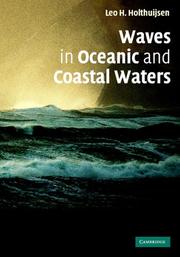
Waves in Oceanic and Coastal Waters describes the observation, analysis and prediction of wind-generated waves in the open ocean, in shelf seas, and in coastal regions with islands, channels, tidal flats and inlets, estuaries, fjords and lagoons. Most of this richly illustrated book is devoted to the physical aspects of waves. After introducing observation techniques for waves, both at sea and from space, the book defines the parameters that characterise waves. Using basic statistical and physical concepts, the author discusses the prediction of waves in oceanic and coastal waters, first in terms of generalised observations, and then in terms of the more theoretical framework of the spectral energy balance. He gives the results of established theories and also the direction in which research is developing. The book ends with a description of SWAN (Simulating Waves Nearshore), the preferred computer model of the engineering community for predicting waves in coastal waters.
Water waves --- Ocean waves --- Mathematical models --- -Ocean waves --- -532.593 --- 551.466 --- 626/627 --- Breakers --- Sea waves --- Surf --- Swell --- Oceanography --- Surface waves (Water) --- Hydrodynamics --- Waves --- Wind waves --- Billows. Shallow waves. Large waves. Theory of sea waves. Deep waves. Ground swell --- Sea waves and tides --- Hydraulic engineering and construction. Water, aquatic structures --- Mathematical models. --- 626/627 Hydraulic engineering and construction. Water, aquatic structures --- 551.466 Sea waves and tides --- 532.593 Billows. Shallow waves. Large waves. Theory of sea waves. Deep waves. Ground swell --- 532.593 --- Water waves - Mathematical models --- Ocean waves - Mathematical models
Book
ISBN: 0273011391 Year: 1979 Publisher: London : Pitman,
Abstract | Keywords | Export | Availability | Bookmark
Loading...Choose an application
- Reference Manager
- EndNote
- RefWorks (Direct export to RefWorks)
River engineering --- Rivers --- -627.1 --- 626/627 --- 627 --- 627.152 --- Brooks --- Creeks --- Runs (Rivers) --- Streams --- Bodies of water --- Engineering, River --- Hydraulic engineering --- Water resources development --- Regulation --- Natural inland waters --- Hydraulic engineering and construction. Water, aquatic structures --- Natural waterway, port, harbour and shore engineering. Navigational, dredging, salvage and rescue facilities. Dams and hydraulic power plant --- Rivers and streams --- River engineering. --- Regulation. --- 627.152 Rivers and streams --- 627 Natural waterway, port, harbour and shore engineering. Navigational, dredging, salvage and rescue facilities. Dams and hydraulic power plant --- 626/627 Hydraulic engineering and construction. Water, aquatic structures --- 627.1 Natural inland waters --- 627.1 --- Regulation of rivers --- Stream regulation --- Streamflow regulation --- Rivers.
Book
ISBN: 0444421815 Year: 1983 Publisher: Amsterdam : Elsevier Science Publishers,
Abstract | Keywords | Export | Availability | Bookmark
Loading...Choose an application
- Reference Manager
- EndNote
- RefWorks (Direct export to RefWorks)
Géomorphologie --- Geomorphology --- environment --- Étude de cas --- case studies --- Projet de développement --- Development projects --- 551.4 --- 631.47 --- 581.524.4 --- 626/627 --- Geomorphic geology --- Physiography --- Physical geography --- Landforms --- Geomorphology. Study of the Earth's physical forms --- Surveying, classification and utilization of land. Soil profiles. Litter. Humus. Topsoil. Subsoil etc. Micropedology --- Zonation --- Hydraulic engineering and construction. Water, aquatic structures --- 626/627 Hydraulic engineering and construction. Water, aquatic structures --- 581.524.4 Zonation --- 631.47 Surveying, classification and utilization of land. Soil profiles. Litter. Humus. Topsoil. Subsoil etc. Micropedology --- 551.4 Geomorphology. Study of the Earth's physical forms --- Geomorphologie appliquee
ISBN: 0419250107 9780419250104 9780419250203 0419250204 0203861620 9780203861622 135198893X 1315272490 1282575910 9786612575914 Year: 2010 Publisher: London : Spon Press,
Abstract | Keywords | Export | Availability | Bookmark
Loading...Choose an application
- Reference Manager
- EndNote
- RefWorks (Direct export to RefWorks)
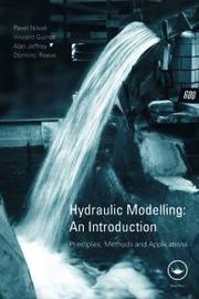
Modelling forms a vital part of all engineering design, yet many hydraulic engineers are not fully aware of the assumptions they make. These assumptions can have important consequences when choosing the best model to inform design decisions.Considering the advantages and limitations of both physical and mathematical methods, this book will help you identify the most appropriate form of analysis for the hydraulic engineering application in question. All models require the knowledge of their background, good data and careful interpretation and so this book also provides guidance on the
Hydraulic engineering --- -Hydrodynamics --- -Hydraulic structures --- 532 --- 556 --- 626/627 --- Structural engineering --- Fluid dynamics --- Engineering, Hydraulic --- Engineering --- Fluid mechanics --- Hydraulics --- Shore protection --- Data processing --- Mathematical models --- Fluid mechanics in general. Mechanics of liquids (hydromechanics) --- Hydrosphere. Water in general. Hydrology --- Hydraulic engineering and construction. Water, aquatic structures --- 626/627 Hydraulic engineering and construction. Water, aquatic structures --- 532 Fluid mechanics in general. Mechanics of liquids (hydromechanics) --- 556 Hydrosphere. Water in general. Hydrology --- Hydrodynamics --- Hydraulic structures --- Génie hydraulique --- Hydrodynamique --- Ouvrages hydrauliques --- Mathematics --- Informatique --- Mathématiques --- Modèles mathématiques --- Informatique. --- Mathématiques. --- Modèles mathématiques. --- Data processing. --- Mathematics. --- Mathematical models. --- Mathématiques. --- Modèles mathématiques.
ISBN: 9810228988 9810230567 9781615830398 1615830391 9789810228989 9789810230562 9789812795748 981279574X Year: 1997 Volume: v. 12 Publisher: Singapore : World Scientific Publishing Co,
Abstract | Keywords | Export | Availability | Bookmark
Loading...Choose an application
- Reference Manager
- EndNote
- RefWorks (Direct export to RefWorks)
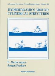
This book discusses the subject of wave/current flow around a cylinder, the forces induced on the cylinder by the flow, and the vibration pattern of slender structures in a marine environment. The primary aim of the book is to describe the flow pattern and the resulting load which develops when waves or current meet a cylinder. Attention is paid to the special case of a circular cylinder. The development in the forces is related to the various flow patterns and is discussed in detail. Regular as well as irregular waves are considered, and special cases like wall proximities (pipelines) are also investigated. The book is intended for MSc students with some experience in basic fluid mechanics and for PhD students.
532.52 --- 532.51 --- 621.644 --- 626/627 --- Offshore structures --- -Underwater pipelines --- Cylinders --- -Wave resistance (Hydrodynamics) --- Ocean currents --- Currents, Oceanic --- Ocean circulation --- Water currents --- Ocean surface topography --- Resistance, Wave (Hydrodynamics) --- Hydrodynamics --- Ocean waves --- Ship resistance --- Ships --- Marine pipelines --- Oceanic pipelines --- Offshore pipelines --- Submarine pipelines --- Underwater pipe lines --- Pipelines --- Marine structures --- Offshore installations --- Structures, Offshore --- Hydraulic engineering --- Ocean engineering --- 626/627 Hydraulic engineering and construction. Water, aquatic structures --- Hydraulic engineering and construction. Water, aquatic structures --- 621.644 Pipelines and their construction --- Pipelines and their construction --- 532.51 Liquid motion in general. Hydrodynamics in the strict sense --- Liquid motion in general. Hydrodynamics in the strict sense --- 532.52 Conditions of fluid motion --- Conditions of fluid motion --- Ocean currents. --- Underwater pipelines. --- Wave resistance (Hydrodynamics). --- Underwater pipelines --- Wave resistance (Hydrodynamics) --- Hydrodynamics.
| Listing 1 - 10 of 10 |
Sort by
|