| Listing 1 - 1 of 1 |
Sort by
|

ISBN: 1281933716 9786611933715 9812791175 9789812791177 981238569X 9789812385697 Year: 2003 Publisher: River Edge, N.J. : World Scientific,
Abstract | Keywords | Export | Availability | Bookmark
 Loading...
Choose an application
- Reference Manager
- EndNote
- RefWorks (Direct export to RefWorks)
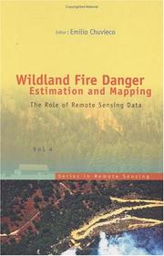
The book presents a wide range of techniques for extracting information from satellite remote sensing images in forest fire danger assessment. It covers the main concepts involved in fire danger rating, and analyses the inputs derived from remotely sensed data for mapping fire danger at both the local and global scale. The questions addressed concern the estimation of fuel moisture content, the description of fuel structural properties, the estimation of meteorological danger indices, the analysis of human factors associated with fire ignition, and the integration of different risk factors in
Fire risk assessment. --- Forest fire forecasting. --- Remote sensing. --- Vegetation mapping. --- Wildfires --- Remote-sensing imagery --- Remote sensing systems --- Remote terrain sensing --- Sensing, Remote --- Terrain sensing, Remote --- Aerial photogrammetry --- Aerospace telemetry --- Detectors --- Space optics --- Fire extinction --- Fire prevention --- Plant mapping --- Plants --- Cartography --- Fire hazard analysis --- Fire hazard assessment --- Fire risk analysis --- Fires --- Hazard analysis, Fire --- Hazard assessment, Fire --- Risk analysis, Fire --- Risk assessment --- Forecasting, Forest fire --- Forest fires --- Wildfire forecasting --- Prevention and control. --- Mapping --- Forecasting --- Prevention and control
| Listing 1 - 1 of 1 |
Sort by
|

 Search
 Feedback
 About
About Help
Help News
News