
 Search
 Feedback
 About UniCat
  Help
Help News
News
| Listing 1 - 7 of 7 |
Sort by
|
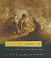
ISBN: 0226476944 Year: 1998 Publisher: Chicago (Ill.) University of Chicago Press
Abstract | Keywords | Export | Availability | Bookmark
 Loading...
Choose an application
- Reference Manager
- EndNote
- RefWorks (Direct export to RefWorks)
Ever since a Native American prepared a paper "charte" of the lower Colorado River for the Spaniard Hernando de Alarcon in 1540, Native Americans have been making maps in the course of encounters with whites. This book charts the history of these cartographic encounters, examining native maps and mapmaking from the pre- and post-contact periods. G. Malcolm Lewis provides accessible and detailed overviews of the history of native North American maps, mapmaking, and scholarly interest in these topics. Other contributions include a study of colonial Aztec cartography that highlights the connections among maps, space, and historyan account of the importance of native maps as archaeological evidenceand an interpretation of an early-contact-period hide painting of an actual encounter involving whites and two groups of warring natives. Although few original native maps have survived, contemporary copies and accounts of mapmaking form a rich resource for anyone interested in the history of Native American encounters or the history of cartography and geography.
Indian cartography --- Indians of North America --- Inuit --- First contact with Europeans. --- Maps. --- America --- Discovery and exploration
Book
ISBN: 077359678X 0773596771 9780773596771 9780773596788 9780773544482 0773544488 9780773544499 0773544496 Year: 2015 Publisher: Montreal & Kingston
Abstract | Keywords | Export | Availability | Bookmark
Loading...Choose an application
- Reference Manager
- EndNote
- RefWorks (Direct export to RefWorks)
Exploring alternative conceptualizations of maps and mapmaking, this book theorizes the potentially creative and therapeutic uses of maps for indigenous healing from the legacies of residential schools and colonial dispossession.
Indians of North America --- Indian cartography --- Indigenous peoples --- History. --- Social aspects. --- Ethnic identity.
Book
ISBN: 9780773544499 Year: 2015 Publisher: Montreal McGill-Queen's University Press
Abstract | Keywords | Export | Availability | Bookmark
Loading...Choose an application
- Reference Manager
- EndNote
- RefWorks (Direct export to RefWorks)
Indian cartography --- Names, Geographical --- Geographical perception --- Human geography --- Memes --- Social aspects --- Social aspects
Book
ISBN: 9781477317525 9781477317518 9781477317532 9781477317549 1477317538 1477317546 1477317511 147731752X Year: 2021 Publisher: Austin
Abstract | Keywords | Export | Availability | Bookmark
Loading...Choose an application
- Reference Manager
- EndNote
- RefWorks (Direct export to RefWorks)
Trail of Footprints offers an intimate glimpse into the commission, circulation, and use of indigenous maps from colonial Mexico. A collection of sixty largely unpublished maps from the late sixteenth to the eighteenth centuries and made in the southern region of Oaxaca anchors an analysis of the way ethnically diverse societies produced knowledge in colonial settings. Mapmaking, proposes Hidalgo, formed part of an epistemological shift tied to the negotiation of land and natural resources between the region’s Spanish, Indian, and mixed-race communities. The craft of making maps drew from social memory, indigenous and European conceptions of space and ritual, and Spanish legal practices designed to adjust spatial boundaries in the New World. Indigenous mapmaking brought together a distinct coalition of social actors—Indian leaders, native towns, notaries, surveyors, judges, artisans, merchants, muleteers, collectors, and painters—who participated in the critical observation of the region’s geographic features. Demand for maps reconfigured technologies associated with the making of colorants, adhesives, and paper that drew from Indian botany and experimentation, trans-Atlantic commerce, and Iberian notarial culture. The maps in this study reflect a regional perspective associated with Oaxaca’s decentralized organization, its strategic position amidst a network of important trade routes that linked central Mexico to Central America, and the ruggedness and diversity of its physical landscape.
Ethnology. Cultural anthropology --- Geodesy. Cartography --- Regional documentation --- History of Mexico --- Cartography --- Indian cartography --- Aztec cartography. --- Manuscripts, Mexican. --- History. --- Mexico --- History
ISBN: 0226550966 Year: 1996 Publisher: Chicago London University of Chicago Press
Abstract | Keywords | Export | Availability | Bookmark
Loading...Choose an application
- Reference Manager
- EndNote
- RefWorks (Direct export to RefWorks)
Aztec cartography --- Cartography --- Indian cartography --- History. --- 528.9 --- Cartography. Mapping (textual documents) --- 528.9 Cartography. Mapping (textual documents) --- Cartography, Indian --- Indians --- Cartography, Primitive --- Chartography --- Map-making --- Mapmaking --- Mapping (Cartography) --- Mathematical geography --- Surveying --- Map projection --- Maps --- Aztecs --- Cartography, Aztec --- History --- Mexico --- New Spain --- Cartography - Mexico - History. --- Cartography - New Spain - History. --- Indian cartography - New Spain - History. --- Aztec cartography - History.
Book
ISBN: 1477317538 1477317511 147731752X Year: 2019 Publisher: Austin : University of Texas Press,
Abstract | Keywords | Export | Availability | Bookmark
Loading...Choose an application
- Reference Manager
- EndNote
- RefWorks (Direct export to RefWorks)
Trail of Footprints offers an intimate glimpse into the commission, circulation, and use of indigenous maps from colonial Mexico. A collection of sixty largely unpublished maps from the late sixteenth to the eighteenth centuries and made in the southern region of Oaxaca anchors an analysis of the way ethnically diverse societies produced knowledge in colonial settings. Mapmaking, proposes Hidalgo, formed part of an epistemological shift tied to the negotiation of land and natural resources between the region’s Spanish, Indian, and mixed-race communities. The craft of making maps drew from social memory, indigenous and European conceptions of space and ritual, and Spanish legal practices designed to adjust spatial boundaries in the New World. Indigenous mapmaking brought together a distinct coalition of social actors—Indian leaders, native towns, notaries, surveyors, judges, artisans, merchants, muleteers, collectors, and painters—who participated in the critical observation of the region’s geographic features. Demand for maps reconfigured technologies associated with the making of colorants, adhesives, and paper that drew from Indian botany and experimentation, trans-Atlantic commerce, and Iberian notarial culture. The maps in this study reflect a regional perspective associated with Oaxaca’s decentralized organization, its strategic position amidst a network of important trade routes that linked central Mexico to Central America, and the ruggedness and diversity of its physical landscape.
Cartography --- Indian cartography --- Aztec cartography. --- Manuscripts, Mexican. --- History. --- Mexico --- History --- Mexican manuscripts --- Aztecs --- Cartography, Aztec --- Cartography, Indian --- Indians --- Cartography, Primitive --- Chartography --- Map-making --- Mapmaking --- Mapping (Cartography) --- Mathematical geography --- Surveying --- Map projection --- Maps
Book
ISBN: 1282796143 9786612796142 1861897499 1861894368 Year: 2009 Publisher: London : Reaktion Books,
Abstract | Keywords | Export | Availability | Bookmark
Loading...Choose an application
- Reference Manager
- EndNote
- RefWorks (Direct export to RefWorks)
In this reinterpretation of U.S. history, the author argues that, until now, writing about and popular understanding of the exploration and mapping of the New World has largely ignored the pivotal role played by indigenous people.
Cartography --- Indian cartography --- Indians of North America --- History --- First contact with Europeans --- West (U.S.) --- Discovery and exploration. --- Cartography, Indian --- Indians --- Cartography, Primitive --- Chartography --- Map-making --- Mapmaking --- Mapping (Cartography) --- Mathematical geography --- Surveying --- Map projection --- Maps --- American aborigines --- American Indians --- First Nations (North America) --- Indians of the United States --- Indigenous peoples --- Native Americans --- North American Indians --- Culture --- Ethnology --- American West --- Trans-Mississippi West (U.S.) --- United States, Western --- Western States (U.S.) --- Western United States --- First contact with other peoples
| Listing 1 - 7 of 7 |
Sort by
|