
 Search
 Feedback
 About
About Help
Help News
News
| Listing 1 - 10 of 12 | << page >> |
Sort by
|
ISBN: 0849390923 9780849390920 Year: 2007 Publisher: Boca Raton (Fla.) : CRC press,
Abstract | Keywords | Export | Availability | Bookmark
 Loading...
Choose an application
- Reference Manager
- EndNote
- RefWorks (Direct export to RefWorks)
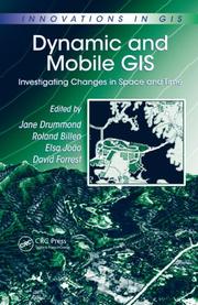
Consisting primarily of papers presented at the GIS Research UK Conference held at the University of Glasgow, Dynamic and Mobile GIS: Investigating Changes in Space and Time provides a contemporary overview of the representation, processing, visualization, and update of dynamic spatio-temporal events using the GIS environment. This book highlights innovations in technology, new ways of modeling both spatial objects and dynamic processes affecting them, and advances in visualization. Featuring contributions from established GIS workers, this text presents the current state-of-the-art in key aspects of mobile and dynamic GIS, exploring important research directions and future challenges.
GISRUK. --- Geografie --- Geographic information systems. --- Mobile GIS. --- Mobile communication systems. --- Space and time. --- Geografische Informatie Systemen --- Toepassingen.
Book
ISBN: 0128001895 0127999493 1322166935 9780128001899 9780127999494 9780127999494 Year: 2014 Publisher: London, [England] ; Waltham, Massachusetts : Academic Press,
Abstract | Keywords | Export | Availability | Bookmark
Loading...Choose an application
- Reference Manager
- EndNote
- RefWorks (Direct export to RefWorks)
This book explains the basic principles of satellite navigation technology with the bare minimum of mathematics and without complex equations. It helps you to conceptualize the underlying theory from first principles, building up your knowledge gradually using practical demonstrations and worked examples. A full range of MATLAB simulations is used to visualize concepts and solve problems, allowing you to see what happens to signals and systems with different configurations. Implementation and applications are discussed, along with some special topics such as Kalman Filter and Ionosphere. W
Artificial satellites in navigation. --- Galileo satellite navigation system. --- Geography --- Earth & Environmental Sciences --- Geography-General --- Mobile geographic information systems. --- Field geographic information systems --- Field GIS --- Mobile GIS --- Geographic information systems --- Location-based services --- Mobile computing
Book
ISBN: 1450343449 Year: 2016 Publisher: New York, New York : Association for Computing Machinery,
Abstract | Keywords | Export | Availability | Bookmark
Loading...Choose an application
- Reference Manager
- EndNote
- RefWorks (Direct export to RefWorks)
Annotation MobiHoc'16: The Seventeenth ACM International Symposium on Mobile Ad Hoc Networking and Computing Jul 05, 2016-Jul 08, 2016 Paderborn, Germany. You can view more information about this proceeding and all of ACM#65533;s other published conference proceedings from the ACM Digital Library: http://www.acm.org/dl.
Mobile computing. --- Mobile geographic information systems. --- Field geographic information systems --- Field GIS --- Mobile GIS --- Geographic information systems --- Location-based services --- Mobile computing --- Electronic data processing --- Context-aware computing --- Portable computers
Book
ISBN: 1450345824 Year: 2016 Publisher: New York : ACM,
Abstract | Keywords | Export | Availability | Bookmark
Loading...Choose an application
- Reference Manager
- EndNote
- RefWorks (Direct export to RefWorks)
Mobile computing --- Mobile geographic information systems --- Location-based services --- LBS (Information services) --- Location-based computing --- Mobile location services --- Telegeoinformatics --- Information services --- Wireless localization --- Field geographic information systems --- Field GIS --- Mobile GIS --- Geographic information systems
Book
ISBN: 1608075664 9781608075669 9781608075652 1608075656 Year: 2014 Publisher: Boston : [Piscataqay, New Jersey] : Artech House, IEEE Xplore,
Abstract | Keywords | Export | Availability | Bookmark
Loading...Choose an application
- Reference Manager
- EndNote
- RefWorks (Direct export to RefWorks)
Geospatial computing includes utilizing computing devices and sensors to acquire, process, analyze, manage, and visualize geospatial data, which users can then interact with via a large variety of smart geospatial applications. Geospatial computing is a computational-demanding task, in terms of computation power, data storage capacity, and memory space. Therefore, it has primarily been performed on non-mobile computers. Recent developments allow smartphones to meet many of the demanded requirements for geospatial computing. This book addresses the topic of geospatial computing in smartphones, including positioning, mobile Geographic Information Systems (GIS) and smart mobile applications. You are provided with aspects related to positioning methods, as well as solutions for geospatial data acquisition, processing, and visualization. This resource also covers various aspects of the application technologies, such as context detection and context intelligence.
Mobile geographic information systems. --- Mobile computing. --- Electronic data processing --- Context-aware computing --- Portable computers --- Field geographic information systems --- Field GIS --- Mobile GIS --- Geographic information systems --- Location-based services --- Mobile computing
Book
ISBN: 1596931515 9781596931510 1596931507 9781596931503 Year: 2013 Publisher: Boston : [Piscataqay, New Jersey] : Artech House, IEEE Xplore,
Abstract | Keywords | Export | Availability | Bookmark
Loading...Choose an application
- Reference Manager
- EndNote
- RefWorks (Direct export to RefWorks)
Introduction. GNSS System Description. Antenna Characteristics. GNSS Antenna Requirements. GNSS Antenna Designs. Multiband GNSS Antennas. Ground Plane, Aircraft Fuselage and Other Platform and Environmental Effects on GPS Antennas. Measurement of GNSS Antenna Characteristics. Antennas and Site Considerations for Precise Applications. Cosite Interference Issues for GPS Antennas on Aircraft and Mitigation Techniques. Adaptive Antenna Arrays and Anti-Jam Signal Processing Techniques--
Global Positioning System. --- Antenna arrays. --- Mobile geographic information systems. --- Field geographic information systems --- Field GIS --- Mobile GIS --- Geographic information systems --- Location-based services --- Mobile computing --- Arrays, Antenna --- Antennas (Electronics) --- Large space structures (Astronautics) --- Global Navigation Satellite System --- GNSS (Navigational system) --- GPS (Navigational system) --- Navigation Satellite Timing and Ranging Global Positioning System --- NAVSTAR GPS --- Artificial satellites in navigation --- Mobile geographic information systems
Book
ISBN: 9781782165910 1782165916 1782165908 9781782165903 9781782165903 1299664555 9781299664555 Year: 2013 Publisher: Birmingham : Packt Pub.,
Abstract | Keywords | Export | Availability | Bookmark
Loading...Choose an application
- Reference Manager
- EndNote
- RefWorks (Direct export to RefWorks)
Filled with practical, step-by-step instructions and clear explanations for the most important and useful tasks. The book will take a how-to approach, focusing on recipes that demonstrate geolocation in HTML5.This book is for web developers who want to incorporate geolocation technology into their applications. Previous knowledge about geolocation software or standards is not required. However, this book assumes a general understanding of web technologies, and both Javascript and jQuery in particular.
HTML (Document markup language) --- Mobile geographic information systems. --- Application program interfaces (Computer software) --- Application software --- Internet programming. --- Computer programming --- Development of application software --- APIs (Computer software) --- Interfaces, Application program (Computer software) --- Field geographic information systems --- Field GIS --- Mobile GIS --- Geographic information systems --- Location-based services --- Mobile computing --- HyperText Markup Language (Document markup language) --- Document markup languages --- Development.
Book
ISBN: 9789811919725 Year: 2022 Publisher: Singapore Springer Nature Singapore :Imprint: Springer
Abstract | Keywords | Export | Availability | Bookmark
Loading...Choose an application
- Reference Manager
- EndNote
- RefWorks (Direct export to RefWorks)
This book is dedicated for engineers and researchers who would like to increase the knowledge in area of mobile mapping systems. Therefore, the flow of the derived information is divided into subproblems corresponding to certain mobile mapping data and related observations’ equations. The proposed methodology is not fulfilling all SLAM aspects evident in the literature, but it is based on the experience within the context of the pragmatic and realistic applications. Thus, it can be supportive information for those who are familiar with SLAM and would like to have broader overview in the subject. The novelty is a complete and interdisciplinary methodology for large-scale mobile mapping applications. The contribution is a set of programming examples available as supportive complementary material for this book. All observation equations are implemented, and for each, the programming example is provided. The programming examples are simple C++ implementations that can be elaborated by students or engineers; therefore, the experience in coding is not mandatory. Moreover, since the implementation does not require many additional external programming libraries, it can be easily integrated with any mobile mapping framework. Finally, the purpose of this book is to collect all necessary observation equations and solvers to build computational system capable providing large-scale maps.
Mobile geographic information systems. --- Field geographic information systems --- Field GIS --- Mobile GIS --- Geographic information systems --- Location-based services --- Mobile computing --- Robotics. --- Computer science --- Computer vision. --- Mathematical Applications in Computer Science. --- Computer Vision. --- Mathematics. --- Machine vision --- Vision, Computer --- Artificial intelligence --- Image processing --- Pattern recognition systems --- Computer mathematics --- Electronic data processing --- Mathematics --- Automation --- Machine theory
Book
ISSN: 18632246 ISBN: 3642342027 3642428673 1283945975 3642342035 Year: 2013 Publisher: Berlin, Heidelberg : Springer Berlin Heidelberg : Imprint: Springer,
Abstract | Keywords | Export | Availability | Bookmark
Loading...Choose an application
- Reference Manager
- EndNote
- RefWorks (Direct export to RefWorks)
The book consists of peer-reviewed papers from the 9th symposium on Location Based Services (LBS) which is targeted to researchers, industry/market operators and students of different backgrounds (scientific, engineering and humanistic). As the research field is developing and changing fast, this book follows up on current trends and gives suggestions and guidance to further research. This book offers a common ground bringing together various disciplines and practice, knowledge, experiences, plans and ideas on how LBS can and could be improved and on how it will influence both science and society. The book comprises front-end publications organized into sections on: spatial-temporal data acquisition, processing & analysis; positioning / indoor positioning; way-finding / navigation (indoor / outdoor) & smart mobile phone navigation; interactions, user studies and evaluations; innovative LBS systems & applications.
Electronics in navigation. --- Location-based services -- Congresses. --- Mobile geographic information systems. --- Wireless communication systems. --- Geography --- Earth & Environmental Sciences --- Cartography --- Location-based services. --- Multimedia cartography. --- Field geographic information systems --- Field GIS --- Mobile GIS --- Mapping, Multimedia --- Multimedia mapping --- LBS (Information services) --- Location-based computing --- Mobile location services --- Telegeoinformatics --- Geography. --- Computers. --- Geographical information systems. --- Geographical Information Systems/Cartography. --- Information Systems and Communication Service. --- Geographic information systems --- Location-based services --- Mobile computing --- Information services --- Wireless localization --- Information systems. --- Geographical information systems --- GIS (Information systems) --- Information storage and retrieval systems --- Automatic computers --- Automatic data processors --- Computer hardware --- Computing machines (Computers) --- Electronic brains --- Electronic calculating-machines --- Electronic computers --- Hardware, Computer --- Computer systems --- Cybernetics --- Machine theory --- Calculators --- Cyberspace
Book
ISBN: 9783211730171 3211730125 9783211730126 3211730176 Year: 2008 Publisher: Vienna : Springer Vienna : Imprint: Springer,
Abstract | Keywords | Export | Availability | Bookmark
Loading...Choose an application
- Reference Manager
- EndNote
- RefWorks (Direct export to RefWorks)
“GNSS - GPS, GLONASS, Galileo and more” is the extension of the scientific bestseller “GPS - Theory and Practice” to Global Navigation Satellite Systems (GNSS) and includes the Russian GLONASS, the European system Galileo, and additional systems. The book refers to GNSS in the generic sense to describe the various existing reference systems for coordinates and time, the satellite orbits, the satellite signals, observables, mathematical models for positioning, data processing, and data transformation. With respect to the individual systems GPS, GLONASS, Galileo and more, primarily the specific reference systems, services, the space and the control segment, as well as satellite signals are described. Furthermore, augmentations by space- and ground-based systems are discussed. This book is a university-level introductory textbook and is intended to serve as a reference for students as well as for professionals and scientists in the fields of geodesy, surveying engineering, navigation, and related disciplines.
Geosciences. --- Geophysics/Geodesy. --- Physical geography. --- Géographie physique --- Geographic information systems. --- Global navigation. --- Global positioning system. --- Mobile geographic information sytems --- Global Positioning System --- Artificial satellites in navigation --- Satellite geodesy --- Galileo satellite navigation system --- Physics --- Mechanical Engineering --- Geography --- Engineering & Applied Sciences --- Earth & Environmental Sciences --- Physical Sciences & Mathematics --- Aeronautics Engineering & Astronautics --- Geography-General --- Cosmic Physics --- Mobile geographic information sytems. --- Global Positioning System. --- Artificial satellites in navigation. --- Satellite geodesy. --- Galileo satellite navigation system. --- Mobile geographic information systems. --- Artificial satellites in geodesy --- Global Navigation Satellite System --- GNSS (Navigational system) --- GPS (Navigational system) --- Navigation Satellite Timing and Ranging Global Positioning System --- NAVSTAR GPS --- Field geographic information systems --- Field GIS --- Mobile GIS --- Geography. --- Geophysics. --- Geographical information systems. --- Geographical Information Systems/Cartography. --- Geodesy --- Geodetic satellites --- Navigation --- Mobile geographic information systems --- Geographic information systems --- Location-based services --- Mobile computing --- Geographical information systems --- GIS (Information systems) --- Information storage and retrieval systems --- Geological physics --- Terrestrial physics --- Earth sciences
| Listing 1 - 10 of 12 | << page >> |
Sort by
|